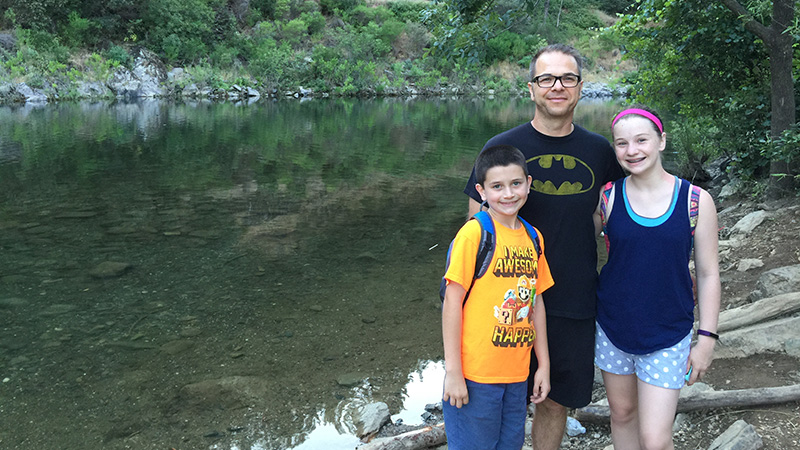
This past year we made it a point to spend our weekends away from our computers, home offices, chores, television, video games, and the allure of crossing a few more things of our to-do lists.
We went on more adventures, hikes, and vacations than we have in any year to date, and we spent a lot of time exploring more of our local area, including Moaning Caverns And Zip Lines, California Caverns, Calaveras Big Trees, Railtown 1897, Historic Columbia, Natural Bridges, Hidden Falls, Codfish Falls, and North Fork Falls.
Clearly, we’re all about hiking and exploring the outdoors. All of us love the peace and quiet, the beauty that surrounds us, and the exercise — we have no problem hitting 10K steps on hiking days!
Over the summer, we also spent time hiking around the American River Confluence in the Auburn State Recreation Area, which is only about 30 minutes from our home. The first trail we hiked was the Quarry Trail to Hawver Cave. We then hiked the Canyon Creek Trail to the Black Hole of Calcutta Falls, and had so much fun, that we came back again to hike the Lake Clementine Trail.
Unlike most hikes, where we get up early and hike before it gets too hot, we decided to shake it up a bit and do this hike in the evening after dinner. While it was a gorgeous hike, and I appreciated the cooler air when the sun went down, I don’t think we’ll be hiking this area in the evening again because there were tons of mosquitoes. TONS. Natalie and I were easily covered in at least 15-20 bites each by the time we were done hiking. If you’re going to do this hike, do it in the morning or bring bug spray!
Finding The Lake Clementine Trail Trailhead
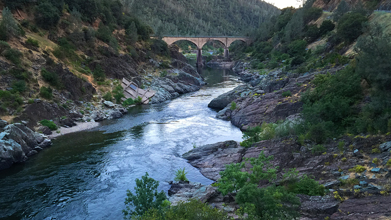
From Auburn, follow Highway 49 south to the American River Confluence. Pass Old Foresthill Road and cross the curved Old Foresthill Bridge. The small parking lot is on the right side of the road and the trailhead is across the street behind a green gate. Parking at the trailhead costs $10, so we parked just a bit up the street near the historic Mountain Quarries Railroad Bridge on the side of the road.

Hiking the Lake Clementine Trail
The Lake Clementine Trail leaves from the American River Confluence area near the informational displays and Ranger kiosk by the end of the curving Old Foresthill Bridge and ends at Lake Clementine Road. Walk past the green gate and follow the trail. You will be paralleling the North Fork of The American River, walking upstream. Before crossing under the Foresthill Bridge, if you look carefully, you can see the concrete abutments from the old Steel Bridge on the opposite side of the riverbank.
This was the first time I had crossed under the Foresthill Bridge. Towering an impressive 730 feet above the river and reaching 2,248 feet across, the Foresthill Bridge is the tallest bridge in California and the third tallest bridge in the United States. The bridge was built in 1973 and was designed to span the reservoir that would have been created upon the completion of the Auburn Dam, a project that was abandoned in 1976. It has been featured in movies, television shows, and commercials.
After passing under the bridge and hiking a bit further, the rushing water of the river slows and the canyon widens out to form a peaceful swimming hole called Clarks Hole. Here the water is deep, clear, and smooth like glass. Because it is lined with boulders, not too cold, and has a small sandy beach, Clarks Hole is a very popular picnic spot and swimming hole for locals and families alike. On a weeknight evening it was quiet and almost empty, but if you visit the swimming hole on the weekend, be prepared for big crowds and a lot more noise!
Even if you’re not going to stop and swim or relax, I highly recommend following the short side trail down to the beach to peek around and check out the beautiful view looking downstream.
As you continue hiking past Clarks Hole, you’ll see more remnants of old bridges on the opposite side of the river, including rock abutments from an old, wood-covered toll bridge. At this point the trail begins to wind away from the river and into the brush, following and old stagecoach route. This portion of the trail to the trail’s end at Lake Clementine Road, finally provides some shade.
Once you reach Lake Clementine Road, you can immediately turn around and head back the way you came, or you can follow the road to the left for just under a half mile, then take another side trail left toward the river to the dam spillway where you can see the water cascading over the North Fork Dam at Lake Clementine.
Because we were hiking at night, and it was already getting dark when we reached Lake Clementine Road, we opted to turn back and call it night, saving the spillway waterfall for another adventure!
Know Before You Go
- The Lake Clementine Trail is 1.9 miles from the Old Foresthill Bridge to Lake Clementine Road. It is another .4 miles to the viewpoint for the dam spillway. If you hike from the trailhead to the spillway viewpoint and back, the total distance is 4.6 miles.
- Because the Lake Clementine Trail follows the the North Fork of the American River upstream and passes the Clarks Hole swimming hole, there are a lot of mosquitoes. Be sure to wear and bring insect repellent and bug spray.
- If hiking in the daytime, almost the entire first portion of the hike to Clarks Hole swimming hole is in direct sun, so bring a hat or wear sunscreen.
- The “waterfall” referenced by many people when talking about this hike is actually the water cascading down the North Fork Dam spillway at Lake Clementine.
- Parking at the trailhead costs $10. Parked near the historic Mountain Quarries Railroad Bridge or on the side of Old Foresthill Road for free.
- There is a lot of Poison Oak along this trail, so stay on the trail.
- Clarks Hole is a large swimming hole with a small sandy beach. It’s a great place to bring your family in the summer for a picnic and some playtime in refreshing river water.


