While Fall River Road was the first road into Rocky Mountain National Park’s high country, it’s narrow road base, steep grades up to 16%, and tight hairpin curves couldn’t handle the vehicle traffic, and a short annual season due to snowpack made a new road necessary.
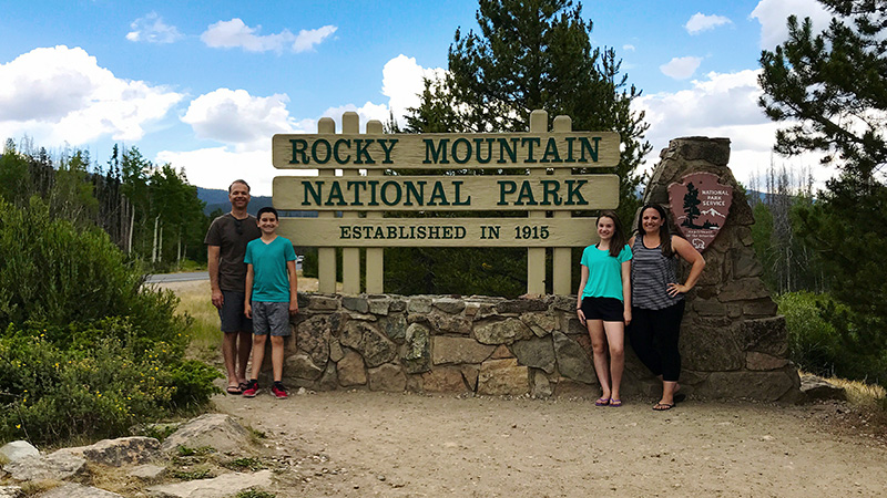
Construction of Trail Ridge Road began in 1929. By 1932, it connected the town of Estes Park to Fall River Pass, and by 1938, it stretched into the Kawuneeche Valley to the town of Grand Lake.
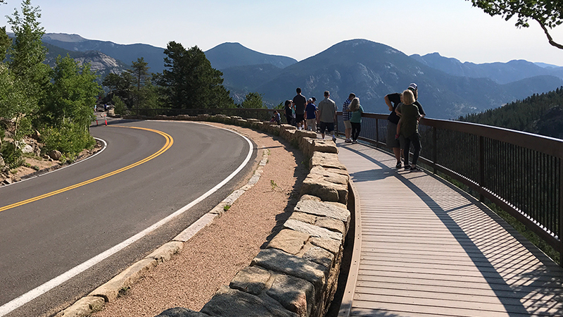
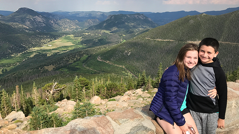
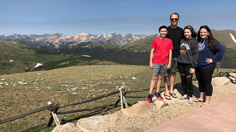
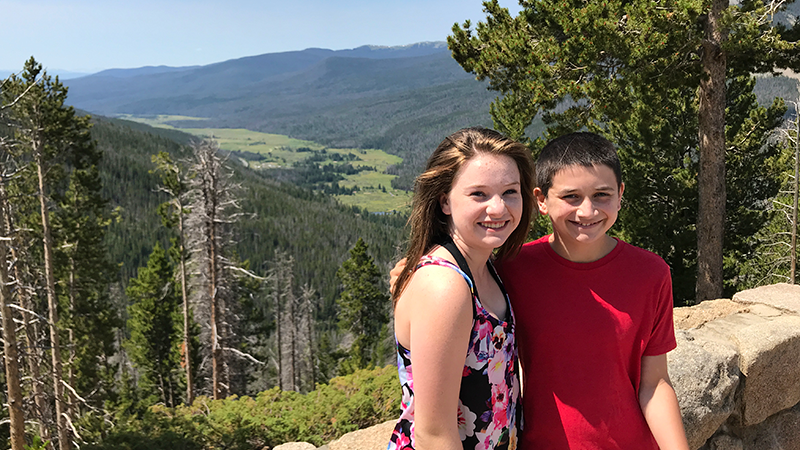
Trail Ridge Road follows Trail Ridge, a high flat spur range extending east from the main range of the Rockies between Fall River in the North and the Big Thompson River in the South. The road was designed to intrude as little as possible into the landscape and provided a much easier route through the park, with a maximum grade of 7%, wide sweeping curves, improved parking areas and stone-walled roadside pullouts, and twelve spectacular scenic overlooks.
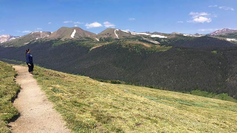
For 15 miles, Trail Ridge Road travels above the treeline through the stunning alpine tundra:
- Eleven miles of the road are above 11,000 feet elevation
- Four miles of the road are above 12,000 feet elevation
- The highest point on Trail Ridge Road is at 12,183 feet elevation between Gorge Range Overlook and Lava Cliffs Overlook.
On Trail Ridge Road — one of America’s National Scenic Byways, a designated All-American Road, and a Colorado State Scenic Byway — you’ll pass through montane forests of aspen and ponderosa pine, subalpine forests of fir and spruce, stunted, wind-battered trees at treeline, and the fragile alpine tundra.
You’ll also get to experience:
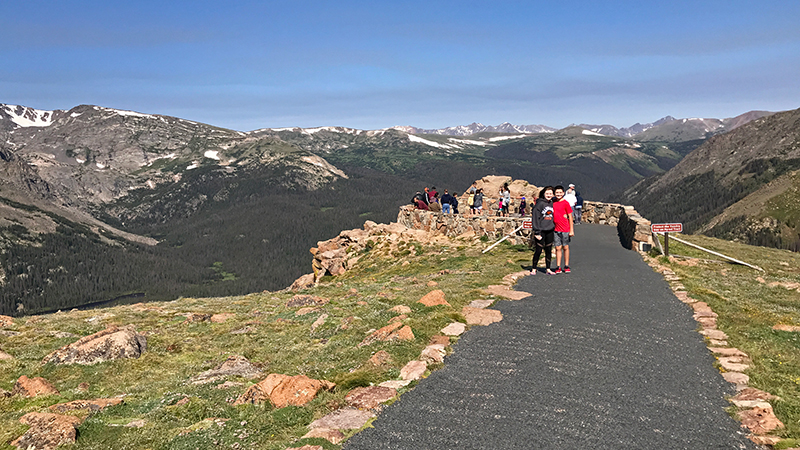
- Stunning panoramic views at 12 breathtaking scenic viewpoints and improved overlooks
- Majestic wildlife sightings of moose, elk, bighorn sheep, deer, pikas, marmots, and ptarmigans
- Gorgeous alpine wildflower blooms blanket the alpine tundra in early summer
Things To Do On Trail Ridge Road
From Deer Ridge Junction in Estes Park on the east side Rocky Mountain National Park to to the Colorado River and Kawuneeche Visitor Center in Grand Lake on the west side, Trail Ridge Road covers 48 miles of US Highway 34 and is the highest continuous road in the Unites States.
Here are 14 things to do and places to see along Trail Ridge Road — in order from Estes park to Grand Lake — that are perfect for families:
01. Beaver Meadows Visitor Center
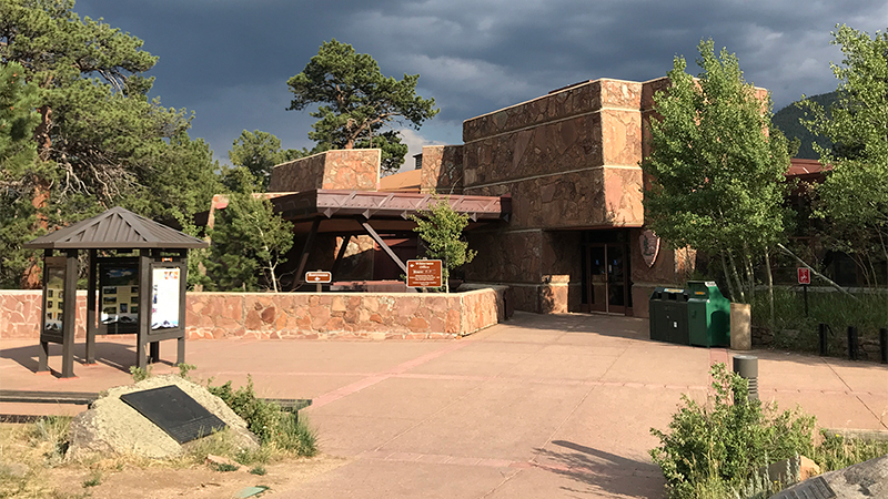
Beaver Meadows Visitor Center, also known as the Rocky Mountain National Park Administration Building, was built in 1967 by Frank Lloyd Wright’s apprentices at Taliesin Associated Architects under the Park Service Mission 66 project.
At 8,231 feet elevation, the Beaver Meadows Visitor Center is located just outside the Beaver Meadows Entrance Station on Highway 36 in Estes Park, Colorado and is the busiest and most popular visitor center in the park.
02. Hidden Valley Beaver Ponds Boardwalk
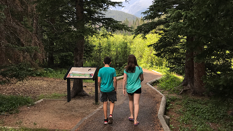
Beaver Ponds Boardwalk is an easy, 0.2 mile, out and back, accessible trail and wooden boardwalk that travels to an observation deck with benches on Hidden Valley Creek in Rocky Mountain National Park.
While it once was home to several beaver colonies whose dams blocked the flow of Hidden Valley Creek and created a series of small ponds, the beavers later moved on and abandoned the dams. Eventually the beaver dams fell apart, the ponds drained, and fertile soil was left behind. Now the wetlands area around Hidden Valley Creek is slowly turning into a lush meadow.
03. Many Parks Curve Overlook
Sitting on the edge of a hairpin turn at 9,691 feet elevation, Many Parks Curve on Trail Ridge Road offers amazing views of Horseshoe Park, Moraine Park, and Estes Park below Mummy Range, the Fall River Pass, Bighorn Mountain, Deer Mountain, and Longs Peak, the highest mountain in Rocky Mountain National Park.
Many Parks Curve Overlook, just above Deer Ridge Junction, is the first scenic viewpoint on Trail Ridge Road when traveling from Estes Park and the eastern Beaver Meadows Entrance Station and the last when traveling from Grand Lake.
Between Many Parks Curve Overlook and Rainbow Curve Overlook, look for signs alongside the road marking the spot at which you are exactly two miles high, or 10,560 feet above sea level.
04. Rainbow Curve Overlook
At 10,875 feet elevation, Rainbow Curve Overlook in Rocky Mountain National Park provides fantastic views of Hidden Valley, Horseshoe Park, Alluvial Fan, Fall River and the Beaver Ponds, and several prominent mountain peaks.
Rainbow Curve, enclosed by a low stone wall, sits on the outer edge of a wide switchback on Trail Ridge Road 12.8 miles from the Beaver Meadows Entrance Station.
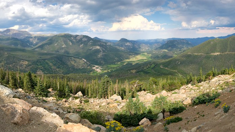
05. Forest Canyon Overlook
At 11,716 feet elevation, Forest Canyon Overlook provides spectacular views of Forest Canyon and the mountains that make up the Continental Divide, as well as yellow bellied marmots, and if you’re lucky, coyote, elk, and sometimes bighorn sheep.
Forest Canyon Overlook offers one of the best views along Trail Ridge Road in Rocky Mountain National Park. The scenic viewpoint sits on the eastern edge of Forest Canyon, an almost 2,000 foot deep, U-shaped valley that was carved by giant glaciers thousands of years ago.
06. Rock Cut Overlook
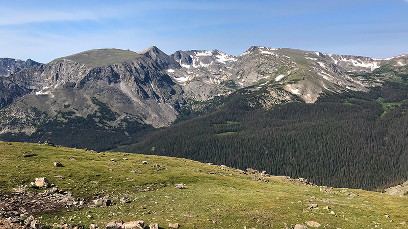
At 12,178 feet elevation, Rock Cut Overlook in Rocky Mountain National Park features stunning views of Longs Peak, the Never Summer Mountain Range, the blue Gorge Lakes, Hayden Gorge, and the pristine alpine tundra above the treeline.
Here, you’ll find access to the Tundra Communities Trail, a 0.5 mile, paved, accessible, out and back trail, to the top of the hill above Rock Cut that totals 1.0 mile.
07. Lava Cliffs Overlook
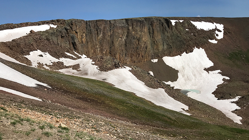
At 12,080 feet elevation, Lava Cliffs Overlook on Trail Ridge Road offers visitors a view of lava formed millions of years ago from volcanic rifts.
The highest point on Trail Ridge Road is located at 12,183 feet elevation, between Lava Cliffs Overlook and Gore Range Overlook.
The highest point on Trail Ridge Road is located at 12,183 feet between Lava Cliffs Overlook and Gore Range Overlook.
08. Gorge Range Overlook
At 12,048 feet elevation, Gore Range Overlook offers spectacular, sweeping views of the Gorge Range, the Never Summer Mountains, and Rocky Mountain National Park’s highest peaks.
Gore Range Overlook is named for Sir St. George Gore, an Irish aristocrat who went on a hunting expedition in the Gore Range led by mountain man Jim Bridger in 1854.
09. Alpine Visitor Center
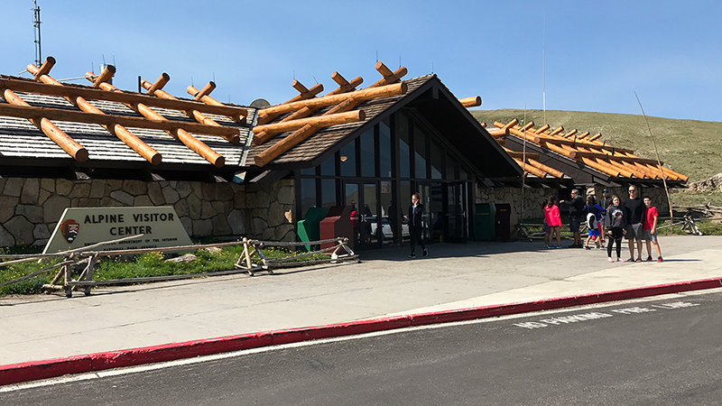
At 11,796 feet elevation, the Alpine Visitor Center in Rocky Mountain National Park is the highest elevation visitor center in the entire National Park System.
Sitting at the top of Fall River Pass at the junction of Trail Ridge Road and Old Fall River Road, the Alpine Visitor Center provides absolutely spectacular views of the alpine tundra, Fall River Cirque, Continental Divide, and the Never Summer Mountains.
10. Medicine Bow Curve Overlook
At 11,640 feet elevation, Medicine Bow Curve is a hairpin switchback on Trail Ridge Road that offers stunning views of the Medicine Bow Mountain Range, now known as the Never Summer Mountains.
On a clear day, you can see Wyoming just 35 miles to the north, and to the west, you can see Mineral Point, the Grand River Ditch, Baker Mountain, Mt. Stratus, Mt. Nimbus, Mt. Cumulus, Red Mountain, and Howard Mountain.
11. Milner Pass And The Continental Divide
At 10,758 feet elevation, in the Front Range within Rocky Mountain National Park, sits Milner Pass, Poudre Lake, and the Continental Divide.
Milner Pass provides passage over the continental divide for Trail Ridge Road between Estes Park and Grand Lake. To the east, you can see Lake Poudre and to the west, you can enjoy a panoramic view of the Never Summer Mountains.
Between Milner Pass and Farview Curve, just west of the Lake Irene turnout, look for a sign alongside the road marking the spot at which you are exactly two miles high, or 10,560 feet above sea level.
12. Farview Curve Overlook
Sitting at 10,148 feet elevation, Farview Curve Overlook in Rocky Mountain National Park offers amazing panoramic views of the Kawuneeche Valley, the Colorado River, and the Never Summer Mountain Range.
Dominating the panoramic vista at Farview Curve are the Never Summer Mountains, the only volcanic mountain range in Rocky Mountain National Park. On a clear day, you can see The Grand Ditch, and below is the Kawuneeche Valley, and the Colorado River.
13. Holzwarth Historic Site
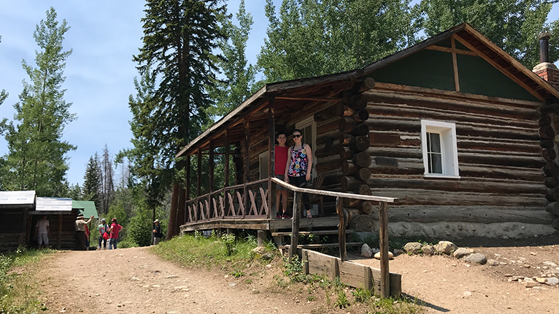
Holzwarth Historic Site, also called Holzwarth Ranch and Holzwarth Trout Lodge, is a group of buildings and cabins that made up a 1920s dude ranch in the Kawuneeche Valley of Rocky Mountain National Park.
Sitting at 8,944 feet elevation just 7.0 miles north of Grand Lake, Colorado, Holzwarth Historic Site offers visitors a glimpse into early homesteading and tourism. While you can go inside and tour the buildings in the summer months, during the winter, the buildings are closed and you can only wander the grounds.
14. Kawuneeche Visitor Center
The Kawuneeche Visitor Center in the Kawuneeche Valley is the only visitor center on the west side of Rocky Mountain National Park.
Sitting at 8,720 feet elevation just outside the Grand Lake Entrance Station, the visitor center is often the first stop for visitors staying in nearby Grand Lake, Colorado and the perfect place to get all the information you need to maximize your time in Rocky Mountain National Park.
Know Before You Go
- Trail Ridge Road is a stretch of US Highway 34 that passes through Rocky Mountain National Park, connecting the town of Grand Lake in Grand County and the town of Estes Park in Larimer County, Colorado.
- Also known as the Beaver Meadow National Scenic Byway, Trail Ridge Road runs from Deer Ridge Junction (US HWY 36 and US HWY 34) on the east side of the park to the Colorado River Trailhead on the western side of the park and snow forces its closure from mid-October to June.
- The two-lane, 48 mile, paved road crosses the Continental Divide at Milner Pass and reaches a maximum elevation of 12,183 feet near Fall River Pass.
- Trail Ridge Road, the highest continuous road in the United States, was added to the National Register of Historic Places in 1984. It is one of ten America’s Byways in Colorado and a nationally designated All American Road.
- Set aside at least a half day to drive Trail Ridge Road — longer if you plan on doing any hiking or sightseeing at one of the many overlooks.
- It’s normally windy and 20 to 30 degrees colder than Estes Park or Grand Lake.
- When at high altitudes, be sure to continue to drink plenty of water, keep an eye out for storms and stay in your car if lightning occurs, and bring layers of clothing and rain gear. Also wear sunglasses and sunscreen because the sun’s ultraviolet rays are twice as intense as they are at sea level. If you begin to feel sick, move to lower elevations.
- The 415 square mile Rocky Mountain National Park is open 24 hours a day, 365 days a year, weather permitting. Download one of the Rocky Mountain National Park brochures and the official park newspaper.