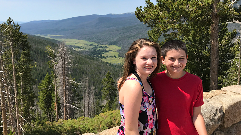
Sitting at 10,148 feet elevation, Farview Curve Overlook in Rocky Mountain National Park offers amazing panoramic views of the Kawuneeche Valley, the Colorado River, and the Never Summer Mountain Range.
- Farview Curve Overlook is the first roadside pullout and scenic viewpoint on Trail Ridge Road when traveling from the Kawuneeche Visitor Center near the western national park entrance and Grand Lake, Colorado.
- If traveling from Estes Park and the eastern park entrance, Farview Curve is approximately 15 miles from the Alpine Visitor Center and the last scenic viewpoint on Trail Ridge Road.
Farview Curve is a smaller scenic viewpoint than some of the other stops along the scenic highway, with little parking, but it’s sweeping mountain and valley views make it well worth the stop.
Dominating the panoramic vista at Farview Curve are the Never Summer Mountains, the only volcanic mountain range in Rocky Mountain National Park. And, on a clear day, you can see The Grand Ditch. It’s a “scar” on the side of the mountain range making an 1890 a water diversion project. The ditch was completed in 1936 and still sends water over the Continental Divide to Colorado’s Eastern Plains.
Below the Never Summer Mountains sits the Kawuneeche Valley, the Colorado River, and the Holzwarth Historic Site. The lush valley is a prime spot to see elk and moose, because they tend to frequent the west side of the park more often. During our Rocky Mountain National Park road trip, we saw three moose and many elk — some with huge antlers — in the Kawuneeche Valley.
We ended up stopping at the Fairview Curve Overlook multiple times on our park visit.
The first time we stopped, we had just hiked Adams Falls, stopped at the Grand Lake Lodge, and visited the Kawuneeche Visitor Center, and were on our way to our hotel in Estes Park. There was a huge afternoon thunderstorm rolling in and the skies were cloudy, dark, grey, and it was starting to rain. But even in the foul weather, the view was still incredibly beautiful.
The second day of our Rocky Mountain National Park visit was sunny and gorgeous, with just a few fluffy white clouds dotting the sky. The weather was so fantastic that we drove Trail Ridge Road all the way to Grand Lake and back again to visit all the scenic overlooks one more time in the sun. While it took almost the whole day, it was well worth it. The views were simply breathtaking. Plus, during our second stop, a friendly ranger was on hand at the overlook to share facts about the view, the park, and some history about the area, which was a bonus!
Know Before You Go
- Farview Curve is a scenic overlook on Trail Ridge Road in Rocky Mountain National Park. From this vista point at 10,148 feet elevation, you can see the Kawuneeche Valley, Colorado River, and Never Summer Mountain Range, the only volcanic mountain range in the park.
- Trail Ridge Road is a stretch of US Highway 34 that passes through Rocky Mountain National Park, connecting the town of Grand Lake in Grand County and the town of Estes Park in Larimer County, Colorado.
- Also known as the Beaver Meadow National Scenic Byway, Trail Ridge Road runs from Deer Ridge Junction (US HWY 36 and US HWY 34) on the east side of the park to the Colorado River Trailhead on the western side of the park and snow forces its closure from mid-October to June.
- The two-lane, 48 mile, paved road crosses the Continental Divide at Milner Pass and reaches a maximum elevation of 12,183 feet near Fall River Pass.
- Trail Ridge Road, the highest continuous road in the United States, was added to the National Register of Historic Places in 1984.
- Other things to do along Trail Ridge Road include: the Holzwarth Historic Site, Milner Pass and Lake Poudre, Medicine Bow Curve Overlook, the Alpine Visitor Center, Gore Range Overlook, Lava Cliffs Overlook, Rock Cut Overlook, Forest Canyon Overlook, Rainbow Curve Overlook, Many Parks Curve Overlook, and the Hidden Valley Beaver Ponds Boardwalk.
- Set aside at least a half day to drive Trail Ridge Road — longer if you plan on doing any hiking or sightseeing at one of the many overlooks.


