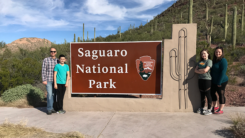
The giant saguaro cactus, with it’s two arms bent upward, is an iconic symbol of the American Southwest. Found only in part of the majestic Sonoran Desert, saguaros are the nation’s largest cacti and are protected by Saguaro National Park in Arizona.
Located in the heart of the Sonoran Desert, Saguaro National Park stretches around the 500 square miles that make up the city of Tucson just 60 miles north of the U.S. Mexican border and about 100 miles south of Arizona’s state capital, Phoenix.
The Formation of Saguaro National Park
Did you know that Saguaro National Park was once a national monument? Here’s a basic rundown of how the national park came to be:
- Saguaro National Monument was created by Herbert Hoover in 1933.
- The 15,360 acre Tucson Mountain District was added in 1961.
- In 1976, 5,378 acres of land were added to the new Tucson Mountain District.
- Another 3,726 acres were added to the area in 1994, and Saguaro National Park was established, encompassing a total of 91,327 acres.
Life In Saguaro National Park
For thousands of years, people have traversed this land and hunted, planted crops, tended livestock, and raised families. The area is the ancestral home of the prehistoric Hohokam people and their descendants, the Tohono O’odham people, who remain an active part of the park’s culture and visit in the early summer to pick saguaro fruit.
The beautiful and varied desert landscapes also provide habitats for wildlife like the javelina, coyote, quail, and desert tortoise in lower elevations, and black bear, deer, and Mexican spotted owl in upper elevations.
Saguaro National Park is also home to 25 cactus species, including the saguaro cactus.
When a saguaro reaches 35 years of age it begins to produce flowers and at around 50-70 years of age, they usually begin to grow arms or branches — although sometimes it can take up to 100 years. An adult saguaro is considered to be about 125 years old, weighing around six tons or more, and stand as tall as 50-70 feet. The average life span of a saguaro is 150-175 years, but biologists believe that some live for more than 200 years.
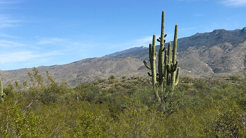
The Two Districts Of Saguaro National Park
Saguaro National Park has two districts approximately 30 miles (45-60 minutes) apart. It is the only national park in the United States that is not connected fully:
- The Rincon Mountain District covers 66,947 acres, rises to over 8,000 feet elevation, and includes over 128 miles of trails, two picnic areas, and the 8.0 mile Cactus Forest Loop Drive. Located about 10 miles east of Tucson, Arizona, this more wild section of the national park is also called Saguaro East. It features an old saguaro forest, oak/pine-oak woodland, and pine/mixed conifer forest and made up the original National Monument.
- The Tucson Mountain District covers 24,498 acres, is lower in elevation, and includes 43 miles of hiking trails, five picnic areas, and the 6.0 mile Bajada Loop Drive. Located about 10 miles west of Tucson, Arizona, this more improved section of the national park is also called Saguaro West. It features a high density, younger saguaro forest.
Here are the best family-friendly things to do at Saguaro National Park:
01. Visit The Red Hills Visitor Center
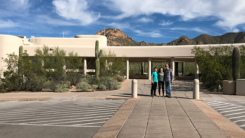
The Red Hills Visitor Center in the Tucson Mountain District of Saguaro West offers park information, maps, and brochures and right from its back porch, spectacular views of the desert landscape, mountains, and Saguaro cacti. Here you can also view museum exhibits and interactive exhibits, pick up souvenirs and gifts, and walk the Cactus Garden Trail.
02. Do The Bajada Loop Drive At Saguaro West
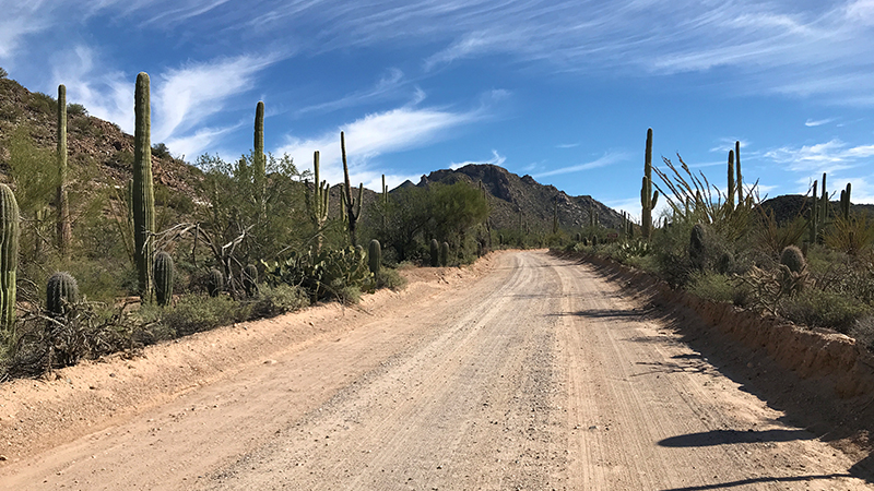
The 6.0 mile scenic Bajada Loop Drive through Saguaro West features spectacular views of the Sonoran Desert, with frequent pullouts for photography, picnicking, walking, hiking, and sight-seeing.
This unpaved, combination one-way and two-way road is passable by all types of vehicles and starts near the Red Hills Visitor Center.
03. Walk The Desert Discovery Trail
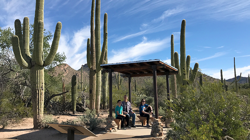
The Desert Discovery Trail is a flat, 0.5 mile paved trail located in the western Tucson Mountain District of Saguaro National Park. It features giant saguaro cacti, interpretive signs about the animals, plants, and ecology of the Sonoran Desert, and shade covers with benches so you can take a break, relax, and enjoy the beautiful landscape that surrounds you.
04. Hike The Valley View Overlook Trail
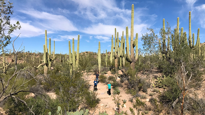
The Valley View Overlook Trail is a relatively easy, 0.4 mile out and back trail, totaling 0.8 miles, that offers spectacular views of the mountains, the Sonoran Desert, and expansive saguaro forests. Built by the Civilian Conservation Corps in the 1930s, the Valley View Overlook Trail features informational signs that identify various cacti and plants.
05. Visit The Signal Hill Petroglyphs
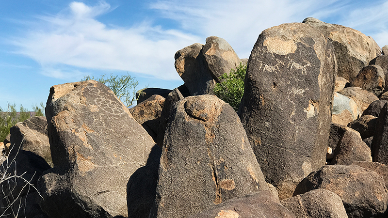
Boasting more than 200 prehistoric Native American petroglyphs, the Signal Hill Petroglyph Site, is the largest petroglyph site in the Tucson Mountain District of Saguaro National Park. It sits immediately north of the Signal Hill Picnic Area, the trail is short and easy, and you can see some of the petroglyphs from the picnic area and trail.
06. Stop By The Rincon Mountain Visitor Center
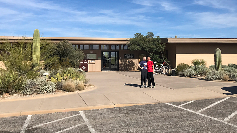
The Rincon Mountain Visitor Center in the eastern Rincon Mountain District of Saguaro National Park is rustic and small. It provides park information, brochures, and maps and offers visitors majestic views of the Rincon Mountains, a nature trail, gift shop, museum exhibits, and more.
07. Do The Cactus Forest Loop Drive At Saguaro East
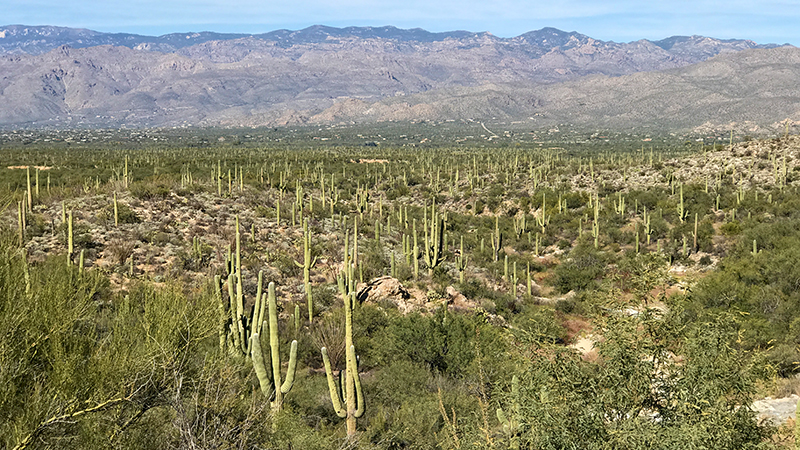
The 8.0 mile scenic Cactus Forest Drive through Saguaro East features stunning views of the Sonoran Desert, giant Saguaro Cacti, and pullouts for photography, picnicking, walking, hiking, and sight-seeing.
The Cactus Forest Loop Drive is open from 7:00 am to sunset daily and you can pick up a print guide that tells you all about the natural and cultural history of the Cactus Forest Loop Drive for $2.00 at the Rincon Mountain Visitor Center before you begin the drive.
08. Check Out The Mica View Trail And Picnic Area
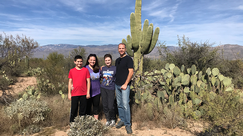
The 2.0 mile round trip, easy, flat Mica View Trail leaves from the Mica View Picnic Area and travels to the Broadway Trailhead and back. While walking this wide, paved, family-friendly trail, enjoy views of the Santa Catalina Mountains to the north, the Rincon Mountains to the east, and Tanque Verde Peak and Mica Mountain to the south. You’ll also see young saguaros under their palo verde “nurse trees”, cholla and prickly pear cacti, and the old, towering saguaro cacti.
09. Walk The Desert Ecology Trail
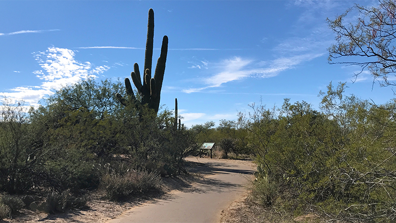
The Desert Ecology Trail at Saguaro East is similar to the Desert Discovery Trail at Saguaro West, but at only 0.25 mile, it’s a little bit shorter.
The easy, flat, paved, Desert Ecology Trail heads north away from Cactus Forest Drive then loops back, following Javelina Wash. Signs along the way tell you about the plants and animals in this Sonoran Desert neighborhood and benches are placed along the trail to rest and relax.
10. Visit Javelina Rocks And The Javelina Picnic Area
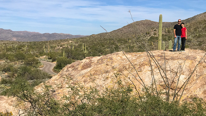
Composed of an ancient granite called Catalina Gneiss, the Javelina Rocks Overlook on Cactus Forest drive provides majestic views of the Tuscon basin and the enormous saguaro cactus — and it’s the best place to experience a sunset at Saguaro East.
The Javelina Picnic Area, trailhead for the popular Tanque Verde Ridge Trail, is nestled in the foothills of the Rincon Mountains. The picnic area has a large parking lot and several covered stone picnic tables with grills.
Know Before You Go
- Saguaro is pronounced sa-wah-ro.
- Saguaro National Park is split into two separate sections, one on each side of the city of Tucson, Arizona in Pima County.
- The Rincon Mountain District to the east rises to over 8,000 feet and includes over 128 miles of trails. The Rincon Mountain Visitor Center is located at 3693 South Old Spanish Trail, Tucson, Arizona 85730.
- The Tucson Mountain District to the west is lower in elevation and has a denser saguaro forest. The district’s Red Hills Visitor Center is located at 2700 North Kinney Road, Tucson, Arizona 85743.
- Saguaro National Park is open 365 days per year. You can walk or bike into the park 24 hours a day. Vehicle access is from sunrise to sunset daily.
- Admission is $15.00/vehicle, $10.00/motorcycle, or $5.00/person and $5.00/bicycle. Free admissions days are offered on Martin Luther King, Jr. Day, the first day of National Park Week, National Public Lands Day, and Veterans Day.
- View maps of Saguaro National Park’s two scenic loop drives and numerous hiking trails and download the park newspaper.
- There are no concession stands, snack/soda machines or restaurants in either section park. Water fountains are found at both visitor centers and only there.
- There is little to no cell reception of service through the entire national park.
- Saguaro National Park has more than 150 miles of designated hiking trails. There is no off-trail hiking unless in areas above 4,500’ elevation. There are also many options for biking.
- Be prepared! It is hot and dry in the Arizona Desert! Carry and drink at least one gallon of water per person, per day, especially in the summer, and bring food and snacks. Wear sunscreen, sturdy shoes, and bring a hat.
- There are six picnic areas accessible by vehicle. Mica View and Javelina are located in the Rincon Mountain District, and Sus, Signal Hill, Cam-boh, and Ez-kim-in-zin are located in the Tucson Mountain District. Each picnic area has at least one picnic table with an overhanging end for wheelchair users and most tables have charcoal grills nearby. The vault toilet in each picnic area is wheelchair accessible.
- Camping is only available in Saguaro National Park’s Rincon Mountain District. All campsites are backcountry wilderness sites meaning you must hike to each site with all of your supplies. There are no showers or any form of running water.
- Pets are allowed only on roadways, picnic areas, and the two paved trails — the Desert Ecology Trail and the Desert Discovery Trail. Pets must be on a leash of no more than six feet at all times.
- All resources (living and non-living) are protected in the National Park. Picking/taking of any resource is prohibited.


