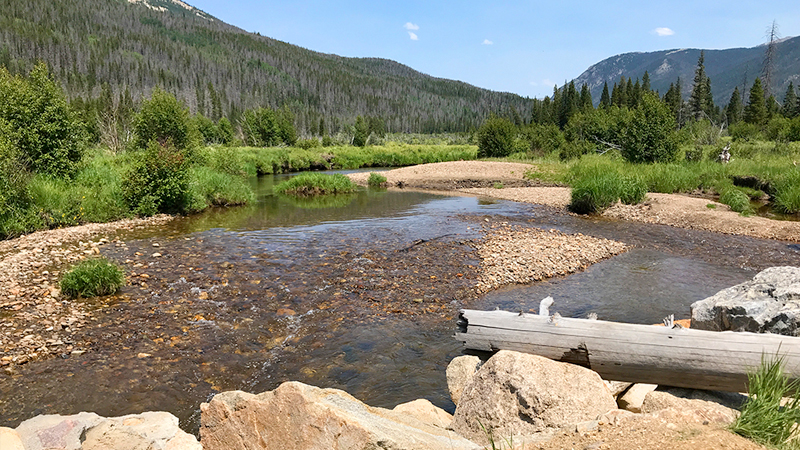
With elevations ranging from 7,860 feet to 14,259 feet, Rocky Mountain National Park is one of the highest national parks in the United States. It crosses the Continental Divide, which runs north to south through the park. It also boasts 60 mountain peaks over 12,000 feet high, including Longs Peak, the highest point in the park.
Covering more than 415 square miles of protected mountains, forests, and alpine tundra, Rocky Mountain National Park provides visitors access to over 350 miles of hiking trails, 150 glacial lakes, 5 campgrounds, and 5 visitor centers, as well as incredible wildlife viewing and spectacular scenic overlooks and vista points. As we explored the park, we saw moose, bighorn sheep, elk, deer, coyotes, foxes, marmots, pikas, and even trout!
There are also two historic roads traveling through the park:
- Trail Ridge Road: With a peak elevation of 12,183 feet, Trail Ridge Road, which travels through the park and connects the towns of Estes Park and Grand Lake, Colorado, is also the highest paved road in the National Park System and the highest continuous road in the United States.
- Old Fall River Road: The first road in Rocky Mountain National Park that provided access to the high country and alpine tundra, that is now an incredible 11 mile, one-way drive from Horseshoe Park to Fall River Pass and the alpine Visitor Center.
Things To Do At Dinosaur National Monument
While we spent 2.5 days touring Rocky Mountain National Park, the first half day was in the afternoon when a huge thunderstorm was rolling in. The skies were dark, cloudy, and gray, it was raining, and lightning could be seen across the sky.
The next two days were sunny and gorgeous, so we basically started over and redid everything we did the day prior and more. This means that you can easily do everything listed in this blog post in two full days.
Here are 27 family-friendly things to do and places to see at Rocky Mountain National Park:
01. Beaver Meadows Visitor Center
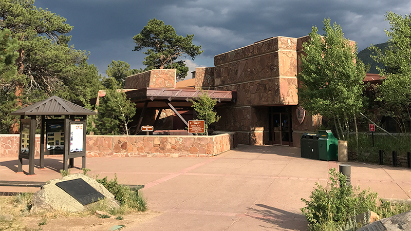
Beaver Meadows Visitor Center, also known as the Rocky Mountain National Park Administration Building, was built in 1967 by Frank Lloyd Wright’s apprentices at Taliesin Associated Architects under the Park Service Mission 66 project.
At 8,231 feet elevation, the Beaver Meadows Visitor Center is located just outside the Beaver Meadows Entrance Station on Highway 36 in Estes Park, Colorado and is the busiest and most popular visitor center in the park.
02. Hidden Valley Beaver Ponds Boardwalk
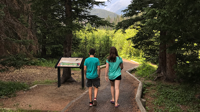
Beaver Ponds Boardwalk is an easy, 0.2 mile, out and back, accessible trail and wooden boardwalk that travels to an observation deck with benches on Hidden Valley Creek in Rocky Mountain National Park.
While it once was home to several beaver colonies whose dams blocked the flow of Hidden Valley Creek and created a series of small ponds, the beavers later moved on and abandoned the dams. Eventually the beaver dams fell apart, the ponds drained, and fertile soil was left behind. Now the wetlands area around Hidden Valley Creek is slowly turning into a lush meadow.
03. Many Parks Curve Overlook
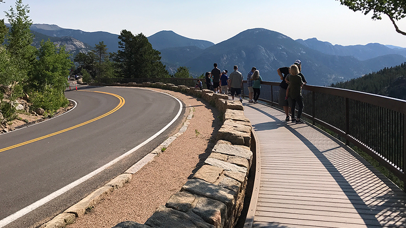
Sitting on the edge of a hairpin turn at 9,691 feet elevation, Many Parks Curve on Trail Ridge Road offers amazing views of Horseshoe Park, Moraine Park, and Estes Park below Mummy Range, the Fall River Pass, Bighorn Mountain, Deer Mountain, and Longs Peak, the highest mountain in Rocky Mountain National Park.
Many Parks Curve Overlook, just above Deer Ridge Junction, is the first scenic viewpoint on Trail Ridge Road when traveling from Estes Park and the eastern Beaver Meadows Entrance Station and the last when traveling from Grand Lake.
04. Rainbow Curve Overlook
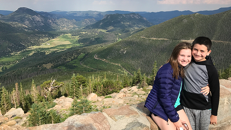
At 10,875 feet elevation, Rainbow Curve Overlook in Rocky Mountain National Park provides fantastic views of Hidden Valley, Horseshoe Park, Alluvial Fan, Fall River and the Beaver Ponds, and several prominent mountain peaks.
Rainbow Curve, enclosed by a low stone wall, sits on the outer edge of a wide switchback on Trail Ridge Road 12.8 miles from the Beaver Meadows Entrance Station.
05. Forest Canyon Overlook
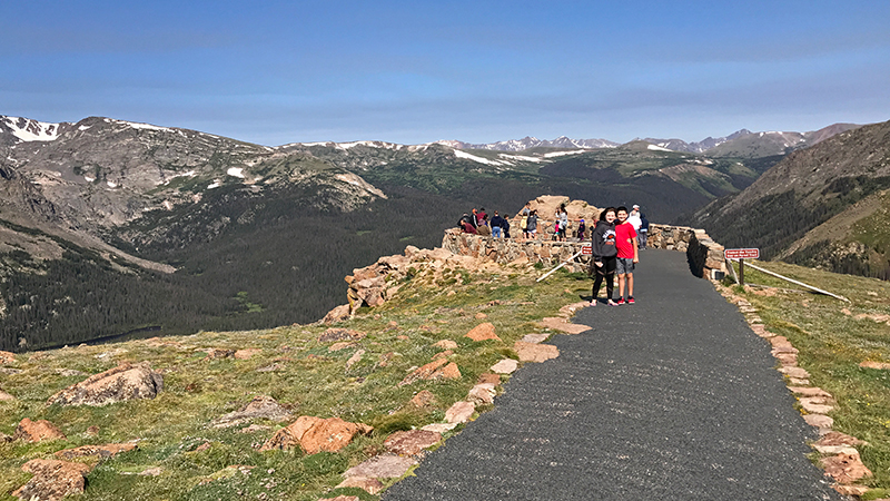
At 11,716 feet elevation, Forest Canyon Overlook provides spectacular views of Forest Canyon and the mountains that make up the Continental Divide, as well as yellow bellied marmots, and if you’re lucky, coyote, elk, and sometimes bighorn sheep.
Forest Canyon Overlook offers one of the best views along Trail Ridge Road in Rocky Mountain National Park. The scenic viewpoint sits on the eastern edge of Forest Canyon, an almost 2,000 foot deep, U-shaped valley that was carved by giant glaciers thousands of years ago.
06. Rock Cut Overlook
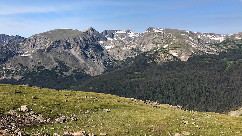
At 12,178 feet elevation, Rock Cut Overlook in Rocky Mountain National Park features stunning views of Longs Peak, the Never Summer Mountain Range, the blue Gorge Lakes, Hayden Gorge, and the pristine alpine tundra above the treeline.
Here, you’ll find access to the Tundra Communities Trail, a 0.5 mile, paved, accessible, out and back trail, to the top of the hill above Rock Cut that totals 1.0 mile.
07. Lava Cliffs Overlook
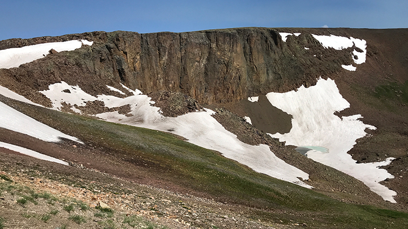
At 12,080 feet elevation, Lava Cliffs Overlook on Trail Ridge Road offers visitors a view of lava formed millions of years ago from volcanic rifts.
The highest point on Trail Ridge Road is located at 12,183 feet elevation, between Lava Cliffs Overlook and Gore Range Overlook.
08. Gorge Range Overlook
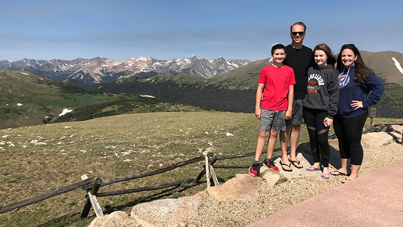
At 12,048 feet elevation, Gore Range Overlook offers spectacular, sweeping views of the Gorge Range, the Never Summer Mountains, and Rocky Mountain National Park’s highest peaks.
Gore Range Overlook is named for Sir St. George Gore, an Irish aristocrat who went on a hunting expedition in the Gore Range led by mountain man Jim Bridger in 1854.
09. Alpine Visitor Center
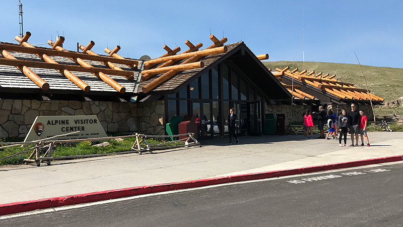
At 11,796 feet elevation, the Alpine Visitor Center in Rocky Mountain National Park is the highest elevation visitor center in the entire National Park System.
Sitting at the top of Fall River Pass at the junction of Trail Ridge Road and Old Fall River Road, the Alpine Visitor Center provides absolutely spectacular views of the alpine tundra, Fall River Cirque, Continental Divide, and the Never Summer Mountains.
10. Medicine Bow Curve Overlook
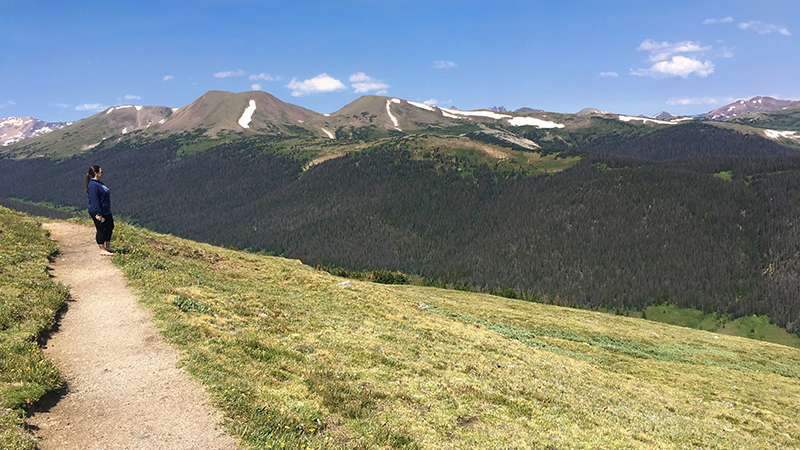
At 11,640 feet elevation, Medicine Bow Curve is a hairpin switchback on Trail Ridge Road that offers stunning views of the Medicine Bow Mountain Range, now known as the Never Summer Mountains.
On a clear day, you can see Wyoming just 35 miles to the north, and to the west, you can see Mineral Point, the Grand River Ditch, Baker Mountain, Mt. Stratus, Mt. Nimbus, Mt. Cumulus, Red Mountain, and Howard Mountain.
11. Milner Pass And The Continental Divide
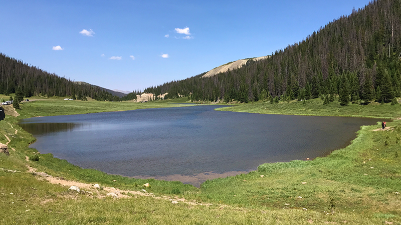
At 10,758 feet elevation, in the Front Range within Rocky Mountain National Park, sits Milner Pass, Poudre Lake, and the Continental Divide.
Milner Pass provides passage over the continental divide for Trail Ridge Road between Estes Park and Grand Lake. To the east, you can see Lake Poudre and to the west, you can enjoy a panoramic view of the Never Summer Mountains.
12. Farview Curve Overlook
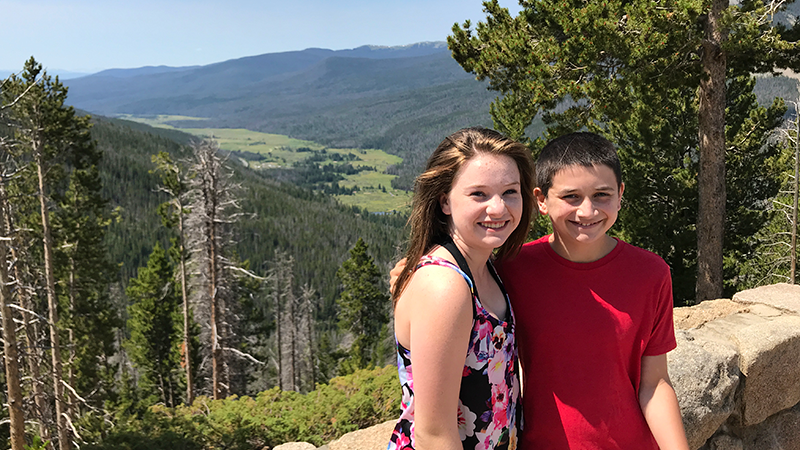
Sitting at 10,148 feet elevation, Farview Curve Overlook in Rocky Mountain National Park offers amazing panoramic views of the Kawuneeche Valley, the Colorado River, and the Never Summer Mountain Range.
Dominating the panoramic vista at Farview Curve are the Never Summer Mountains, the only volcanic mountain range in Rocky Mountain National Park. On a clear day, you can see The Grand Ditch, and below is the Kawuneeche Valley, and the Colorado River.
13. Holzwarth Historic Site
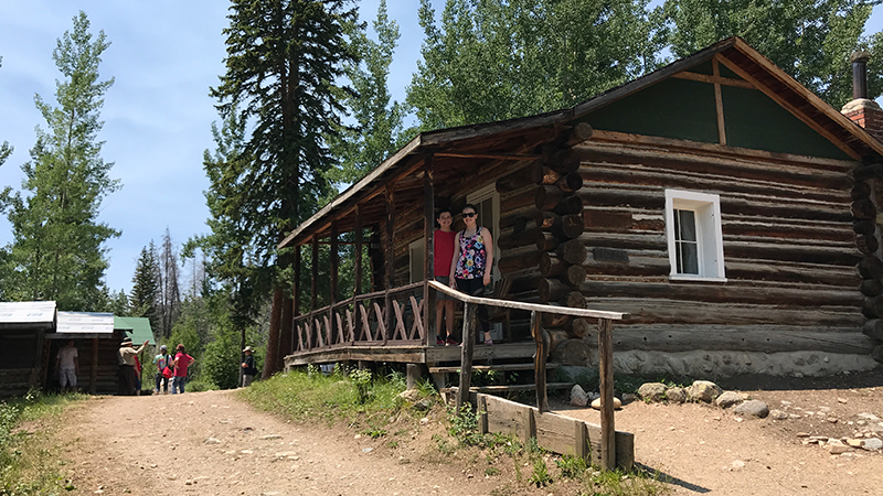
Holzwarth Historic Site, also called Holzwarth Ranch and Holzwarth Trout Lodge, is a group of buildings and cabins that made up a 1920s dude ranch in the Kawuneeche Valley of Rocky Mountain National Park.
Sitting at 8,944 feet elevation just 7.0 miles north of Grand Lake, Colorado, Holzwarth Historic Site offers visitors a glimpse into early homesteading and tourism. While you can go inside and tour the buildings in the summer months, during the winter, the buildings are closed and you can only wander the grounds.
14. Kawuneeche Visitor Center
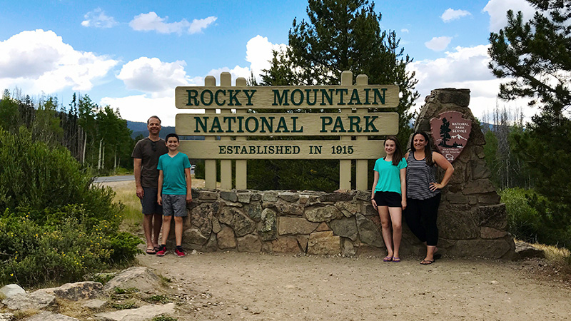
The Kawuneeche Visitor Center in the Kawuneeche Valley is the only visitor center on the west side of Rocky Mountain National Park.
Sitting at 8,720 feet elevation just outside the Grand Lake Entrance Station, the visitor center is often the first stop for visitors staying in nearby Grand Lake, Colorado and the perfect place to get all the information you need to maximize your time in Rocky Mountain National Park.
15. Fall River Visitor Center
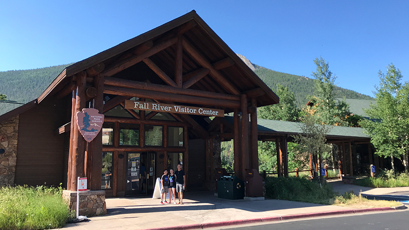
The Fall River Visitor Center is located just outside the Rocky Mountain National Park Fall River Entrance Station on US Highway 34, five miles west of the town of Estes Park. It shares a building and parking lot with the ginormous Gateway Store and Trailhead Restaurant.
16. Old Fall River Road
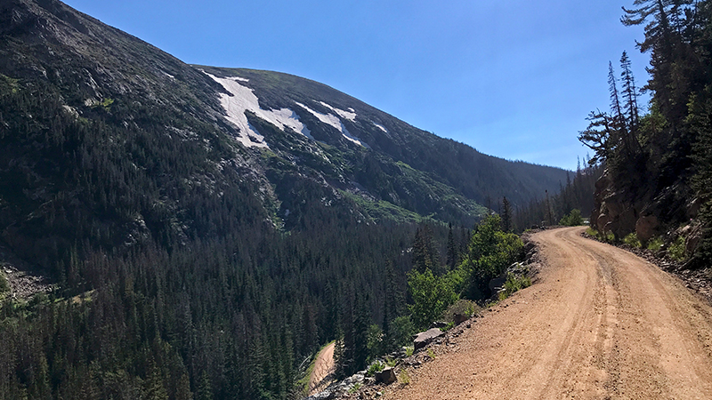
Following the steep slope of Mount Chapin, Old Fall River Road is a narrow, 11 mile dirt and gravel road, with numerous dropoffs, 16 tight switchbacks, and steep grades. Just wide enough for one vehicle, it has a maximum speed of 15 mph and no guard rails.
The road follows a route traveled long ago by Indian hunters. The drive starts at Horseshoe Park and Endovalley at 8,558 feet elevation, and ends at Fall River Pass and the Alpine Visitor Center at 11,796 feet elevation, with the temperature dropping 3-5 degrees for every 1,000 foot gain in elevation.
17. Chasm Falls
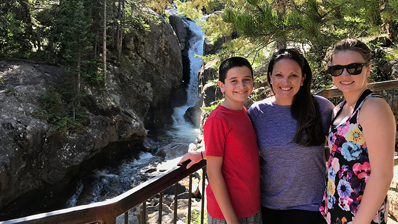
Sitting at 9,068 feet elevation, Chasm Falls is a 25 foot plunging waterfall about 100 yards off Old Fall River Road in Rocky Mountain National Park.
At the top of Chasm Falls, there is a parking area alongside the road for about 10 vehicles. This is also the trailhead for a 0.1 mile, out and back trail to an observation platform. The trail travels downhill and down some natural stairs to the observation platform near the base of the waterfall.
18. Sheep Lakes
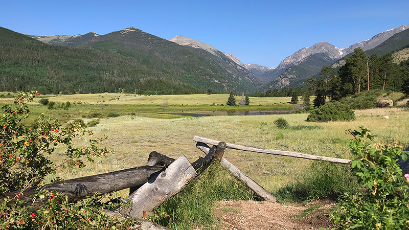
At 8,524 feet elevation, Sheep Lakes is a large meadow with two small lakes in Horseshoe Park, a flat U-shaped valley located just west of the Fall River Entrance.
Sheep Lakes sits at the base of the mountains between the Fall River Visitor Center and the turn off for Fall River Road and the Alluvial Fan. It is a gorgeous, grassy meadow with two beautiful ponds that is frequented by bighorn sheep.
19. Alluvial Fan Waterfall And Picnic Area
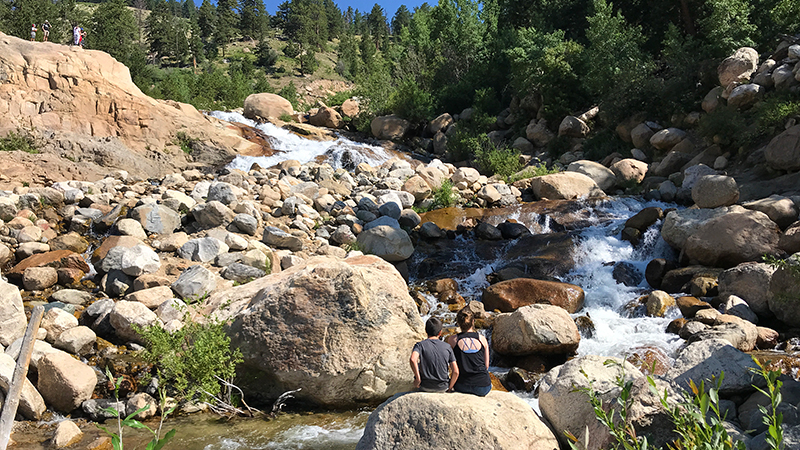
Alluvial Fan is the perfect stop for a picnic lunch and a fantastic stop for families with kids who love to climb rocks and need to burn off some boundless energy. The cool water cascading down the rocks also makes it a great place to pull up a rock and relax.
The 42 acre Alluvial Fan was created in July 1982 when Lawn Lake broke through its terminal moraine and sent 29 million gallons of water crashing down the Roaring River.
20. Horseshoe Park Overlook
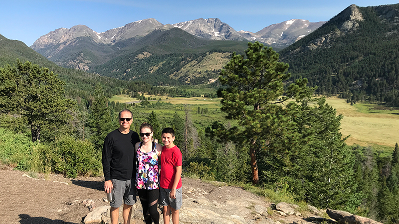
Horseshoe Park Overlook is a paved roadside pullout with informational displays on US Highway 34 near Deer Ridge Junction.
On the edge of this pullout, there is a giant rock outcropping you can walk on for incredible views of Fall River Canyon, Alluvial Fan, Sheep Lakes and the meandering Fall River in Horseshoe Park, snow-capped mountains, and Trail Ridge Road.
21. Copeland Falls In Wild Basin
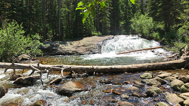
Copeland Falls is a series of waterfall cascades on St. Vrain Creek that pour and tumble over boulders. It is the first waterfall along the main Wild Basin Trail.
The Wild Basin Entrance Station of Rocky Mountain National Park is located approximately 19 miles south of Estes Park between the towns of Meeker and Allenspark on Colorado Route 7 — the Peak to Peak Scenic Highway — in Boulder County.
22. 3M Curve And Longs Peak Viewpoint
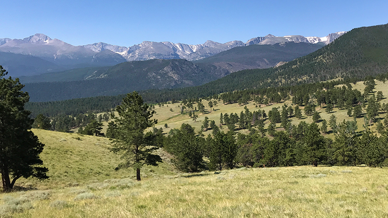
3M Curve, also referred to as Longs Peak Viewpoint, is a scenic viewpoint in Rocky Mountain National Park with a giant rock outcropping and majestic views of Longs Peak, open meadows, and Moraine Park.
3M Curve is located 3.5 miles from Beaver Meadows Visitor Center on the south side of US Highway 36, between Deer Ridge Junction and the Visitor Center.
23. Adams Falls
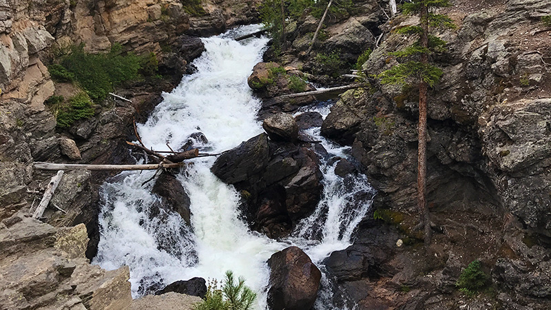
Named after Jay E. Adams, an early settler of Grand Lake, Colorado, Adams Falls is a stunning 55 foot waterfall on the western side of Rocky Mountain National Park just east of Grand Lake. The waterfall sits on the Adams Falls Trail, a short spur trail off the East Inlet Trail. Adams Falls Trail is an easy, 0.6 mile, loop trail along a wide dirt path that follows East Inlet Creek and has a 79 foot elevation gain.
24. Moraine Park Discovery Center
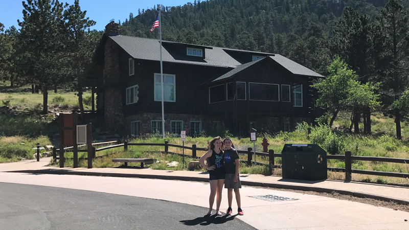
Moraine Park Museum And Amphitheater, also called the Moraine Park Discovery Center and the Moraine Park Lodge, are located off Bear Lake Road in Moraine Park, a glaciated meadow between two moraines in Rocky Mountain National Park.
Sitting just 1.5 miles from the Beaver Meadows Entrance Station, the Moraine Park Discovery Center opened in 1923 and features interactive natural history exhibits on the topics of geologic processes, glaciation, weather and climate, ecosystems, and human impact. There is also a small bookstore, a short nature trail, and beautiful views of Moraine Park.
25. Bear Lake
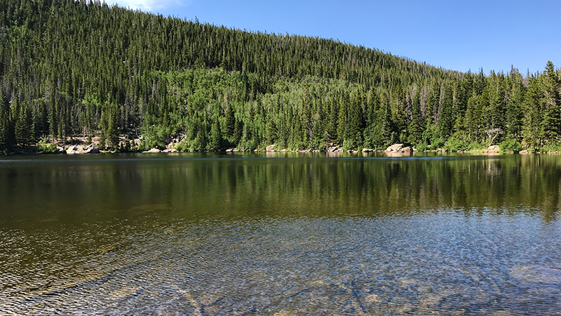
At 9,450 feet elevation, Bear Lake is a subalpine lake that sits beneath the sheer flanks of the 12,713 foot Hallett Peak and the Continental Divide. Located at the end of Bear Lake Road, it is the most popular lake in Rocky Mountain National Park.
Bear Lake Trail, also called the Bear Lake Nature Trail, is an easy, 0.5 mile loop trail that hugs the shoreline of Bear Lake. It is breathtaking and a perfect adventure for families with small children.
26. Alberta Falls
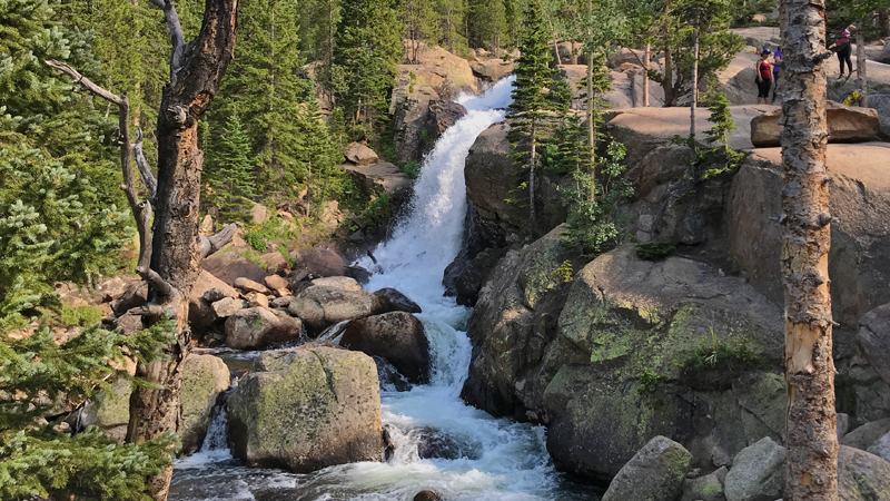
At 9,400 feet elevation, Alberta Falls is a spectacular, 25 foot waterfall on Glacier Creek that roars through a granite chute and plunges down a small gorge.
The hike to Alberta Falls is one of the most popular hikes in Rocky Mountain National Park. The trail passes through a forest of pine and aspen trees, past a magnificent rock cliff at Glacier Gorge, and follows along Glacier Creek until you reach the waterfall. Here, Glacier Creek thunders down the rocks to create a beautiful waterfall and the giant rock slabs next to Alberta Falls provide the perfect spot to sit down, relax, enjoy nature, and even have a picnic!
27. Sprague Lake
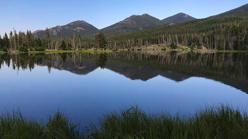
Sprague Lake has lots of parking, a large picnic area along Glacier Creek, a flat walking trail around the lake, gorgeous views, and flush restrooms. At 8,688 feet elevation, the Sprague Lake Trail is an easy, flat, 0.5 mile loop trail around the 13 acre lake that is accessible and features boardwalks and wooden bridges with views of Flattop Mountain and Hallet Peak.
Know Before You Go
- The 415 square mile Rocky Mountain National Park is open 24 hours a day, 365 days a year, weather permitting.
- The Rocky Mountain National Park Administrative Building is located at the Beaver Meadows Visitor Center at 1000 US Highway 36, Estes Park, Colorado 80517.
- The park covers ground in Larimer County, Grand County, and Boulder County, Colorado.
- Download one of the Rocky Mountain National Park brochures and the official park newspaper.
- There are no gas stations inside the park. It is approximately 50 miles between the communities of Grand Lake and Estes Park.
- Do not rely on cell phones inside the park as many locations have no service and pay phones have been removed from most locations. Free WiFi is available at three of the five visitor centers — the Beaver Meadows, Fall River, and Kawuneeche visitor centers.
- A one-day vehicle pass is $20.00 and a seven-day vehicle pass is $30.00. The park offers Free Admission Days on Martin Luther King Jr. Day, the first day of National Park Week, National Public Lands Day, and Veterans Day.
- Rocky Mountain National Park is busiest throughout the summer and on fall weekends. In these busy times, especially between 10:00 am and 3:00 pm there are long lines and wait times at entrance stations, full parking lots, heavy traffic, and crowded trails, and the Bear Lake Road corridor and Wild basin area sometimes closes to personal vehicles.
- Download the free shuttle bus route brochure for Bear Lake Road. Most shuttle buses are accessible and can accommodate wheelchairs but there are no bike racks.
- With the 1803 Louisiana Purchase, the U.S. government acquired the land that became Rocky Mountain National Park in 1915. In September 2015, the Rocky Mountain National Park celebrated its 100th anniversary.
- The park has more than 350 miles of hiking trails and 260 miles of horseback riding trails.
- Only 48 of the more than 150 lakes contain trout populations due to cold water temperatures and a lack of spawning habitat.
- Rocky Mountain National Park is currently home to approximately 300 to 400 bighorn sheep that can be seen in the alpine tundra near Rock Cut Overlook and at Sheep Lakes.
- After visiting Rocky Mountain National Park in 1916, Esther and Elizabeth Burnell enrolled in nature guide training and became the first female nature guides certified by the National Park Service. Elizabeth was the first woman guide on Longs Peak and ran the park’s trail school, while Esther homesteaded in Estes Park, snowshoed 30 miles across the Continental Divide, and married Enos Mills in 1918.
- Rocky Mountain National Park is one of four National Parks in Colorado. The other parks include Great Sand Dunes National Park and Preserve, Mesa Verde National Park, and Black Canyon of the Gunnison National Park.
- Before 1978, there were very few moose in Rocky Mountain National Park. Between 1978 and 1979, 24 moose were relocated from Wyoming to the park and by 1994, the herd grew to 700. Today you can see moose in Kawuneeche Valley and near Sprague Lake along Bear Lake Road.
- Pets are not allowed in any park visitor centers, but official service animals (not therapy or emotional support animals) that have been individually trained to perform specific tasks for the benefit of persons with disabilities are welcome. Pets are also not allowed on shuttle buses, in meadow areas, or on trails even if they are on a leash.
- Dogs are allowed on roads (not closed roads) and in parking areas only and must be on a leash, not exceed six feet in length, at all times when they are outside of your vehicle.
- Trail Ridge Road and Old Fall River Road are closed to pets from the day the roads are closed for the season in autumn until the first Saturday in April.