After spending the day visiting Dinosaur National Monument, checking out the world famous Dinosaur Quarry, driving the Tour Of The Tiled Rocks and exploring all of the stops along the way, and then visiting the Utah Field Natural History State Park Museum, we all were exhausted.
It was 100 degrees that day and everything at Dinosaur except for one short trail is in full sun.
By the time we ate a late dinner at a local brewery, we were ready to crash in our hotel and watch Food Network. (Natalie, Carter, and I love the cooking competition shows.) But alas, that didn’t happen because our motel was nasty and it didn’t even have Food Network. I won’t go into the details of Brian’s choice of lodging for the night except to say #mistakesweremade. Mistakes we won’t be repeating.
I wasn’t going to spend any minute longer than absolutely necessary in that hotel, so I immediately began searching for something to do and found the Moonshine Arch trail.
A hike huge stone arch? Um, yes please.
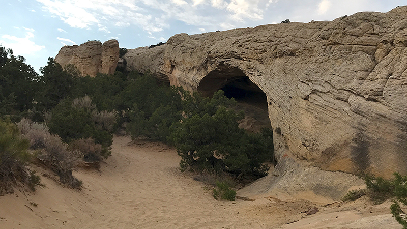
Located just 15 minutes north of Vernal, Utah, Moonshine Arch is a stunning 85 foot long natural sandstone arch with a 40 foot tall window that you can hike to and climb around on.
Moonshine Arch was incredible and the kids had a blast climbing in the caves behind the arch — even if it was dusk and the mosquitoes and bugs were practically swarming us.
The only thing that’s a bit wonky is trying to figure out the directions to Moonshine Arch. To say finding the trailhead is a challenge, is putting it mildly. The directions from Google Maps are wrong, most websites I found had little to no information, and the dirt/gravel road off Highway 191 sits below the highway and it’s very hard to see.
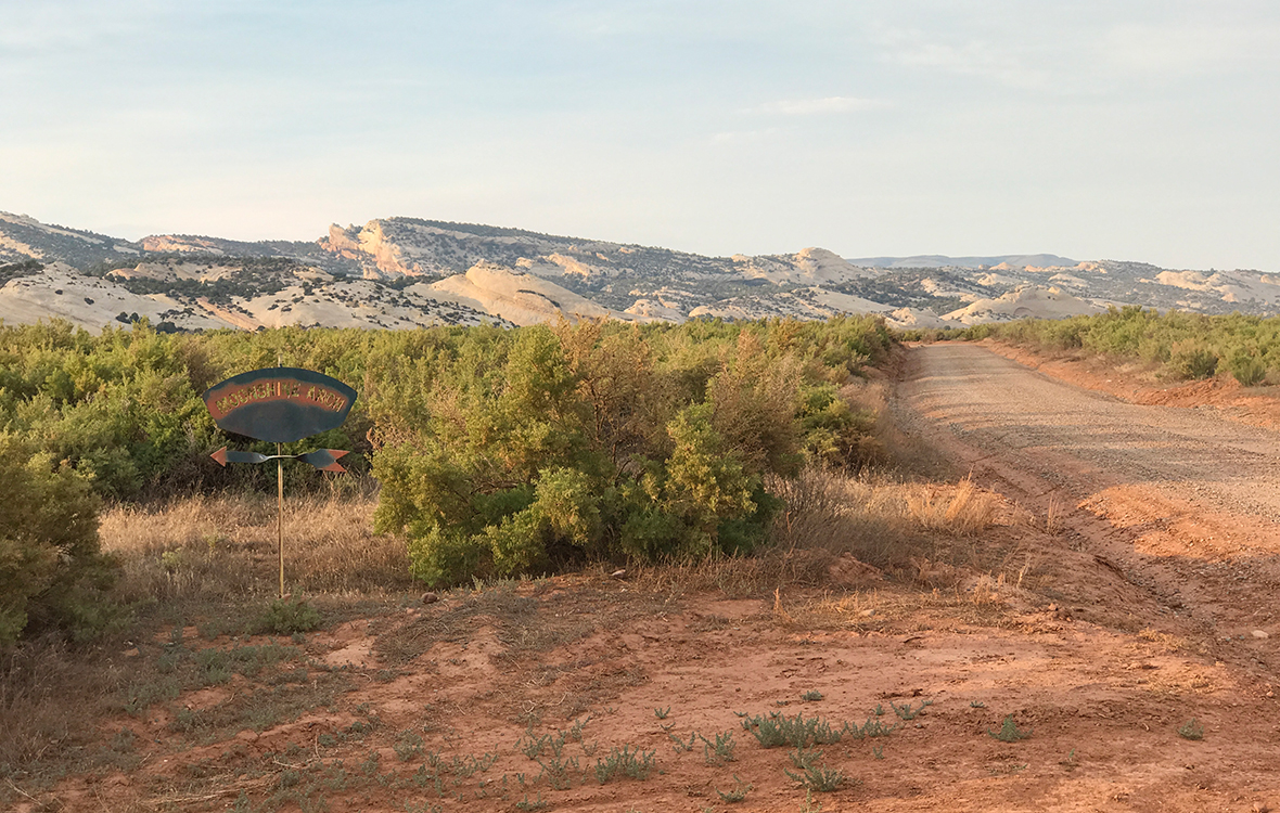
Luckily, after completely missing the turn off and turning around to go back, we found the dirt/gravel road we were supposed to turn on and began driving out into what felt like nowhere. Just when we were questioning if we went the wrong way again, I saw a blueish, rusted, metal Moonshine Arch sign pointing us in the right direction. Eventually we found the trailhead and I documented the real directions to Moonshine Arch as we went and have included them at the bottom of this post.

Hiking To Moonshine Arch
The Moonshine Arch Trail is a sandy, 1.5 mile, out and back trail totaling 3.0 miles round trip. The trail follows an OHV trail and it is an easy to moderate uphill hike all the way to the massive sandstone arch.
After parking at the end of the road, we walked through the green gate, down a rough section of road, onto the sandy OHV trail and followed it straight until seeing another metal Moonshine Arch sign pointing right. Shortly thereafter we reached another green gate meant to keep visitors off private land and the trail turned left.
This was the worst and hardest part of the whole hike.
While the sage and juniper trees lining the trail were beautiful, it was incredibly sandy — deep enough that our shoes were being engulfed by the sand and I eventually took my shoes off and walked barefoot like I would at the beach!
Soon the trail turned again, leading us to the right and up a wide field of slickrock. Some of the climb up the rock gets a bit steep, but overall it’s not too bad and the kids had no problem traversing the rocks. At the top of the climb, we stood on a low ridge and could see a dark area in the sandstone ridge ahead of us that was Moonshine Arch!
We once again dropped down into thick sand and made our way past a BLM sign for the Moonshine Arch Recreation Area to the majestic rock arch and the eroded cliff behind it with small caves you can explore and climb around it.
Moonshine Arch is awesome!
As soon as we reached the arch, the kids took off through the natural window and into the cave behind the arch. We have visited so many places that keep you away and off the rock formations, so they were thrilled to be able to freely climb and explore the rock formations, caves, and cliffs around Moonshine Arch… and being the only people in the entire area wasn’t bad either!
I just wish we had more sun to light up the arch!
We left our hotel at 7:00 pm, which meant our hike was at dusk and the arch wasn’t lit up at all. In fact, it was already getting dark when we reached the arch and we didn’t have flashlights with us, so it wasn’t too long before Brian was rushing us back down the trail to the truck.
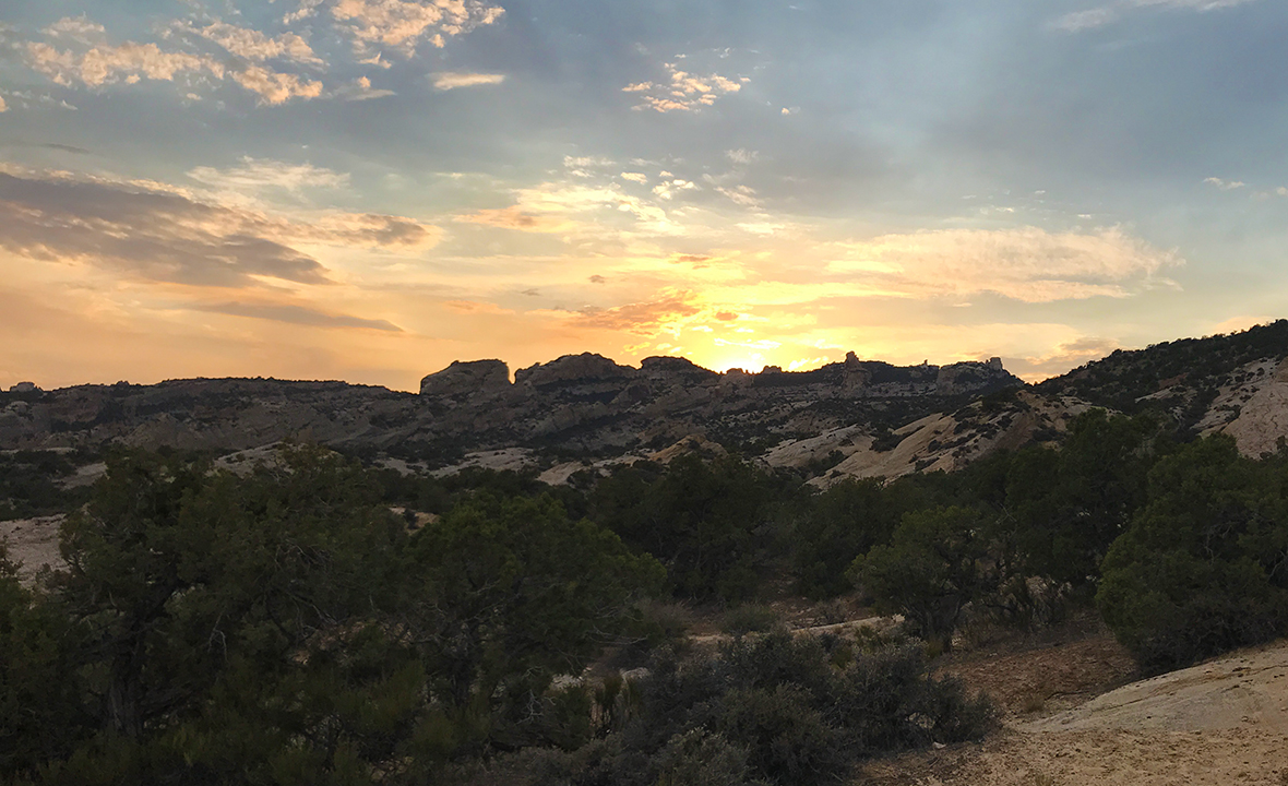
It only took us 30ish minutes to hike through the gorgeous desert landscape to Moonshine Arch, and that’s with us stopping frequently to snap photos. The hike back went much faster because it was all downhill, but we did stop more often for photos of the incredible sunset over the ridge line behind us and the golden desert hills in front of us.
It’s funny… Moonshine Arch never made it to my list of things to do in Vernal, Utah because I never thought we’d have time to do squeeze in anything other than the Utah Field Natural History State Park Museum and Dinosaur National Monument. But wow! We are all so happy we got to see this amazing natural rock arch and hike off our dinner of burgers, pizza, and fries!
And, I guess ending up in a gross motel did have a silver lining…

Know Before You Go
- Moonshine Arch is located in the Moonshine Arch Recreation Area managed by the Bureau Of Land Management (BLM) in Vernal, Utah 84078, Uintah County.
- Moonshine Arch is an incredible natural rock arch that measures 40 feet tall and 85 feet long.
- Access is free.
- The very sandy, out and back trail to Moonshine Arch is approximately 1.5 miles each way in full sun and finding the trailhead is very tough!
- Be sure to wear good hiking shoes, bring plenty of water, and wear sunscreen or a hat.
- The hiking trail follows a sandy and slick rock jeep and OHV trail that is still open to vehicles that can drive right up to the arch — so be careful.
- Dogs are allowed off leash on this trail and in the Moonshine Arch Recreation Area, Just be careful of when you hike with your dog, as the ground and rocks get very hot on summer days.
- This OHV and hiking trail crosses through an open cattle grazing area. If hiking with your dog, have a leash with you just in case.
How To Get To Moonshine Arch
- Head north from Vernal on HWY 191.
- Pass the entrance for Steinaker State Park on the left and go another mile on 191 until the road curves to the right.
- In the middle of the curve (near mile marker 359), turn left onto the unmarked dirt/gravel road — it’s lower than the highway and very hard to see, especially at highway speeds. We accidentally passed it and had to turn around.
- Follow the dirt/gravel road about 0.5 miles to an intersection with a paved road. Here’ you’ll see a blueish metal sign for Moonshine Arch with an arrow pointing left.
- Turn left and follow the paved road until it dead ends at a green BLM gate. Park and follow the trail through the gate.
Do not follow the directions to Moonshine Arch provided by Google Maps that tell you to turn into the Steinaker State Park entrance. That is not the right way. You’ll end up in the wrong spot and waste a lot of time.


