When researching things to do in Rocky Mountain National Park and all of the best sights too see, I discovered that US Highway 34, also known as Trail Ridge Road, travels all the way through the park, connecting the towns of Grand Lake and Estes Park. Trail ridge road has many scenic overlooks, roadside pullouts, vista points, and trailheads to stop at along the drive too, which we love.
What was even better is that to get from Dinosaur National Monument in Utah to our hotel is Estes Park, Colorado, we had to drive Trail Ridge Road, which meant we actually had more time to explore the park than we initially thought!
After hiking to Adams Falls and touring the Grand Lake Lodge outside the park entrance, we visited the Kawuneeche Visitor Center, stopped at Farview Curve Overlook, and checked out the Continental Divide at Milner Pass, and up next on our scenic drive through Rocky Mountain National Park was Medicine Bow Curve Overlook.
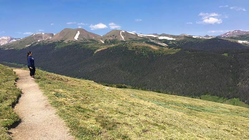
At 11,640 feet elevation, Medicine Bow Curve is a hairpin switchback on Trail Ridge Road that offers stunning views of the Medicine Bow Mountain Range, now known as the Never Summer Mountains.
The Medicine Bow Curve vista point is just west of the Alpine Visitor Center, above the treeline, in the alpine tundra. On a clear day, you can see Wyoming just 35 miles to the north, and to the west, you can see Mineral Point, the Grand River Ditch, Baker Mountain, Mt. Stratus, Mt. Nimbus, Mt. Cumulus, Red Mountain, and Howard Mountain.
At the upper end of the roadside parking area, there is a dirt trail that wraps around the mountainside heading north. It isn’t very long and doesn’t seem to have a name, but Natalie and I walked out along the trail for a while to check out the view and it is well worth the slight detour!
Also, keep your eyes peeled because the alpine tundra in this area is frequented by elk, which we saw several times on our three trips past this scenic viewpoint.
Know Before You Go
- Medicine Bow Curve is a scenic overlook on Trail Ridge Road in Rocky Mountain National Park. From this vista point at 11,640 feet elevation, you can see the Never Summer Mountains, the Medicine Bow National Forest, Wyoming, and several other mountains.
- Trail Ridge Road is a stretch of US Highway 34 that passes through Rocky Mountain National Park, connecting the town of Grand Lake in Grand County and the town of Estes Park in Larimer County, Colorado.
- Also known as the Beaver Meadow National Scenic Byway, Trail Ridge Road runs from Deer Ridge Junction (US HWY 36 and US HWY 34) on the east side of the park to the Colorado River Trailhead on the western side of the park and snow forces its closure from mid-October to June.
- The two-lane, 48 mile, paved road crosses the Continental Divide at Milner Pass and reaches a maximum elevation of 12,183 feet near Fall River Pass.
- Trail Ridge Road, the highest continuous road in the United States, was added to the National Register of Historic Places in 1984.
- Other things to do along Trail Ridge Road include: the Holzwarth Historic Site, Farview Curve Overlook, Milner Pass and Lake Poudre, the Alpine Visitor Center, Gore Range Overlook, Lava Cliffs Overlook, Rock Cut Overlook, Forest Canyon Overlook, Rainbow Curve Overlook, Many Parks Curve Overlook, and the Hidden Valley Beaver Ponds Boardwalk.
- Set aside at least a half day to drive Trail Ridge Road — longer if you plan on doing any hiking or sightseeing at one of the many overlooks.


