On our way to Lava Cliffs Overlook, we stopped at Farview Curve Overlook, the Continental Divide at Milner Pass, Medicine Bow Curve Overlook, the Alpine Visitor Center, and Gore Range Overlook. And, throughout the drive, the bags of chips Natalie and Carter had in the back seat began to expand more and more, until they were about to burst! We waited anxiously as we climbed in elevation for the bags to burst. We even poked at them a bit. But there were no explosions.
Now when you think about Rocky Mountain National Park, you don’t think about lava and volcanoes, but at one scenic overlook high up above the treeline, in the alpine tundra, the view isn’t of vast mountain ranges, it’s of a lava wall!
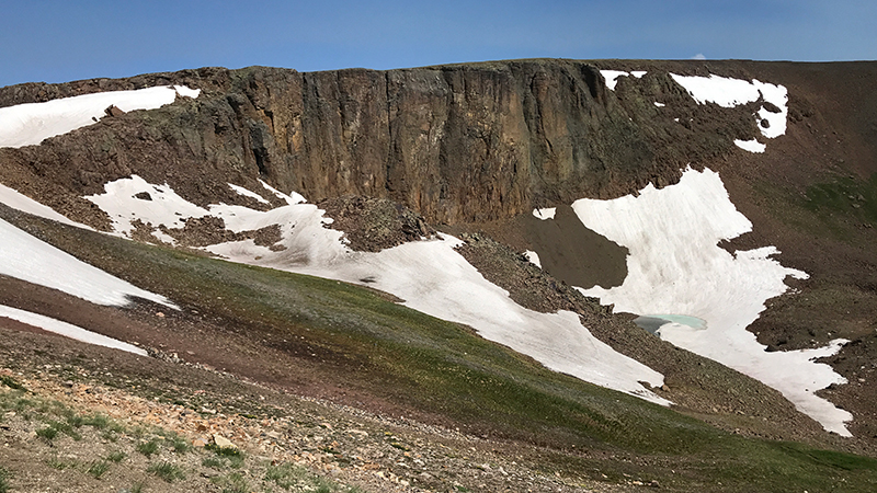
At 12,080 feet elevation, Lava Cliffs Overlook on Trail Ridge Road offers visitors a view of lava formed millions of years ago from volcanic rifts.
According to the Trail Ridge Road guide, the dark cliff northwest of the parking area is composed on volcanic rock, but the name of the overlook is misleading.
Between 28 and 26 million years ago, volcanoes erupted repeatedly in the area of today’s Never Summer Mountains, eight miles to the west. Deposits of volcanic debris frequently blanketed the land. One flow of hot, incandescent ash extended this far, cooling to form hard rock. Much later, glacial ice carved into the hillside and exposed a cross section of the Precambrian Rock to form the lava cliff that you can see from the overlook today.
The highest point on Trail Ridge Road is located at 12,183 feet elevation, between Lava Cliffs Overlook and Gore Range Overlook.
The first time we drove passed this overlook, thunderclouds had filled the sky, it was sprinkling rain, and it was dark. The lava cliffs honestly didn’t look that impressive, but when we stopped again the next day, in the mid-day sun, all I could think was, “Wow!”
The sheer lava cliffs contrast starkly against the beautiful white snow banks, the ice blue pond below, and the rolling green alpine meadows. From this overlook, in the opposite direction, it was also cool to see Trail Ridge Road snaking across the mountain tops, nearly touching the sky!
Know Before You Go
- Lava Cliffs Overlook on Trail Ridge Road in Rocky Mountain National Park sits at 12,080 feet elevation, with views of cliffs of lava formed millions of years ago.
- Trail Ridge Road is a stretch of US Highway 34 that passes through Rocky Mountain National Park, connecting the town of Grand Lake in Grand County and the town of Estes Park in Larimer County, Colorado.
- Also known as the Beaver Meadow National Scenic Byway, Trail Ridge Road runs from Deer Ridge Junction (US HWY 36 and US HWY 34) on the east side of the park to the Colorado River Trailhead on the western side of the park and snow forces its closure from mid-October to June.
- The two-lane, 48 mile, paved road crosses the Continental Divide at Milner Pass and reaches a maximum elevation of 12,183 feet near Fall River Pass.
- Trail Ridge Road, the highest continuous road in the United States, was added to the National Register of Historic Places in 1984.
- Other things to do along Trail Ridge Road include: the Holzwarth Historic Site, Farview Curve Overlook, Milner Pass and Lake Poudre, Medicine Bow Curve Overlook, the Alpine Visitor Center, Gore Range Overlook, Rock Cut Overlook, Forest Canyon Overlook, Rainbow Curve Overlook, Many Parks Curve Overlook, and the Hidden Valley Beaver Ponds Boardwalk.
- Set aside at least a half day to drive Trail Ridge Road — longer if you plan on doing any hiking or sightseeing at one of the many overlooks.


