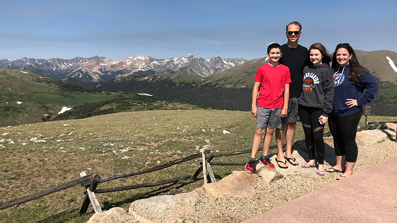
We first entered Rocky Mountain National Park at the West Entrance Station near Grand Lake, and after visiting the Kawuneeche Visitor Center, we began out trek along Trail Ridge Road, the highest continuous road in the United States. We stopped at Farview Curve Overlook, and checked out the Continental Divide at Milner Pass, took in the view at Medicine Bow Curve Overlook, and wandered through the Alpine Visitor Center at the halfway point. From the visitor center on, we began making our way back down the mountains to Estes Park, and our first stop was the Gore Range Overlook.
At 12,048 feet elevation, Gore Range Overlook offers spectacular, sweeping views of the Gorge Range, the Never Summer Mountains, and Rocky Mountain National Park’s highest peaks.
Gore Range Overlook sits above the treeline in the alpine tundra, just down the road from the highest point on Trail Ridge Road (12,183 feet elevation). It was named for Sir St. George Gore, an Irish aristocrat who went on a hunting expedition in the Gore Range that was led by mountain man Jim Bridger in 1854.
From this western-facing roadside pullout, you can see:
- The Never Summer Mountain Range and the summits of Mount Stratus, Mount Nimbus, Mount Cumulus, and Mount Cirrus
- The jagged peaks of the distant Gore Range, running from Vail Pass to Steamboat Springs approximately 60 miles away
- The flat top of Longs Peak, the highest summit in Rocky Mountain National Park
The Never Summer Mountains, originally called the Medicine Bow Mountains, were created by volcanic activity between 25 and 28 million years ago and carved by Ice Age glaciers. The Arapaho Indians renamed the mountain range because snow remains on their highest slopes far into summer.
It was VERY cold at the scenic viewpoint! The climate at the top of Trail Ridge Road is easily 20-30 degrees colder than the bottom of the the road, and with the wind ripping over the mountaintop…
Brrrr! It was chilly!
Know Before You Go
- Gore Range Overlook is a scenic viewpoint on Trail Ridge Road in Rocky Mountain National Park. From this vista point at 12,048 feet elevation, you can see the Gore Range, Longs Peak, Never Summer Mountains.
- Trail Ridge Road is a stretch of US Highway 34 that passes through Rocky Mountain National Park, connecting the town of Grand Lake in Grand County and the town of Estes Park in Larimer County, Colorado.
- Also known as the Beaver Meadow National Scenic Byway, Trail Ridge Road runs from Deer Ridge Junction (US HWY 36 and US HWY 34) on the east side of the park to the Colorado River Trailhead on the western side of the park and snow forces its closure from mid-October to June.
- The two-lane, 48 mile, paved road crosses the Continental Divide at Milner Pass and reaches a maximum elevation of 12,183 feet near Fall River Pass.
- Trail Ridge Road, the highest continuous road in the United States, was added to the National Register of Historic Places in 1984.
- Other things to do along Trail Ridge Road include: the Holzwarth Historic Site, Farview Curve Overlook, Milner Pass and Lake Poudre, Medicine Bow Curve Overlook, the Alpine Visitor Center, Gore Range Overlook, Lava Cliffs Overlook, Rock Cut Overlook, Forest Canyon Overlook, Rainbow Curve Overlook, Many Parks Curve Overlook, and the Hidden Valley Beaver Ponds Boardwalk.
- Set aside at least a half day to drive Trail Ridge Road — longer if you plan on doing any hiking or sightseeing at one of the many overlooks.


