Located in the Shepperd’s Dell State Natural Area, Shepperds Dell is a small canyon in Oregon’s Columbia River Gorge. It is famous for Shepherd’s Dell Falls and the Shepperd’s Dell Bridge that spans the canyon as part of the Historic Columbia River Highway.
Flowing through the canyon is Young Creek, which plunges next to the road to create the 90 foot, two-tier waterfall, and continues flowing under the bridge to the Columbia River. The upper fall drops about 42 feet and the lower fall drops about 50 feet.
Built in 1914, Shepperd’s Dell Bridge provided the answer to a major engineering challenge of the Historic Columbia River Highway’s construction.
While Shepperd’s Dell Falls is well known, it’s very difficult to get a great photo of the waterfall due to the surrounding topography, so the bridge often becomes the subject of visitor photographs instead. As a result, Shepperd’s Dell Bridge is as equally well known as the falls.
Hiking To Shepperd’s Dell Falls
When we took a road trip to Portland to see Dead and Company, we also planned a family day trip to the Columbia River Gorge.
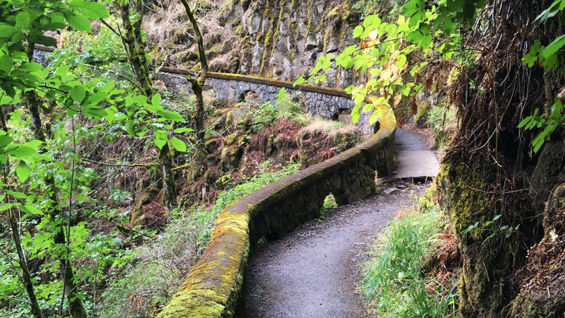
Shepperd’s Dell Falls can be seen right from the Columbia River Highway, so stopping to check it out was really a no-brainer! The hike (really more of a walk) is very short. The trail, cut right into the side of the cliffs, is an easy .2 mile out and back walk to a small waterfall viewing platform.
With the towering, sheer rock cliffs to one side and a stone wall on the other, it’s a peaceful walk. The old stone wall that lines the trail was created by masons working on the Columbia River Highway. It is formed with smooth arches and covered in patches of boldly covered moss, giving the trail a feeling of elegance and beauty.
History of Shepperd’s Dell
Local dairy farmer, George Shepperd, moved to the gorge in the 1880s, settling on a land claim along Young Creek. Over the years,
Samuel Lancaster, chief engineer and designer of the Historic Columbia River Highway, had a vision to preserve the majestic beauty of the gorge and showcase it’s hidden natural features. He wanted to create a highway that was an experience of wonder at every turn instead of the shortest path to get somewhere.
Once construction on the new highway began, George Shepperd received several offers to purchase his land, but he turned them all down. Inspired Samuel Lancaster’s vision, in 1915, he gifted his land to the City of Portland as a memorial to his wife. In 1940, the land was transferred to the Oregon State Parks and became Shepperd’s Dell State Park and eventually Shepperd’s Dell State Natural Area.
Know Before You Go
- Shepperd’s Dell State Natural Area and Shepperd’s Dell Falls is located on the Historic Columbia River Highway in Corbett, Oregon 97019.
- From Shepperd’s Dell Falls, traveling west, it is 1 mile to Latourell Falls, 3.5 miles to Crown Point Vista House, and 4.5 miles to the Portland Women’s Forum State Park. Traveling east, it is 1.5 miles to Bridal Veil Falls, 4.5 miles to Wahkeena Falls and Fairy Falls, 5 miles to Multnomah Falls, 7 miles to Oneonta Falls, 8 miles to Horsetail Falls, and 12 miles to Elowah Falls.
- Download the Columbia River Gorge State Parks Brochure.
- Download a Columbia River Highway Waterfall Map, documenting the waterfalls between Corbett and Dodson.
- The short trail is paved but very rough in spots.
- The waterfall is difficult to get a great photograph of, but if you follow the trail to the falls, you can get a great photo of the gorgeous, historic bridge.
- Shepherds Dell is the name of the geographic feature — a dell is a small wooded valley. Shepperd’s Dell (with the apostrophe) refers to the name of the Shepperd’s Dell State Park and Shepperd’s Dell State Natural Area.


