After exploring the main area of Red Canyon around the Visitor Center and walking the short Red Canyon Hoodoo Trail to the Two Totems rock formation, we hopped in the car to drive out to the Losee Canyon Trailhead and the Arches Trail. It isn’t a long drive, but because the roads are almost all gravel/dirt out to the trailhead, it’s sort of slow going!
At the Losee Canyon Trailhead, the parking area is just an open dirt lot with an information board and trail map. There was only one other vehicle parked in the lot and those were the only other people we saw the entire time we were there.
Arches Trail is a short, 0.7 mile loop trail that takes you on a vigorous hike through a red rock outcropping with 15 rock arches and windows, spectacular rock formations, and incredible views.
Arches Trail #33075 is one of the most popular trails in Red Canyon. It begins just north of the Losee Canyon Trailhead parking area but the official trailhead was washed out by a flash flood. To start the hike, we had to walk past a green animal gate, into Losee Canyon, and across the dry creek bed. There is a sign marking the start of the trail but it isn’t easy to see from the parking area.
Hiking The Arches Trail
We were pretty excited to check out Arches Trail at Red Canyon! We didn’t have time on our spring break road trip to squeeze in visits to Arches National Park and Canyonlands National Park, so this was our chance to see some of Utah’s famous arches.
After walking through the dry wash, the trail begins to climb up the rocky cliffs, passing a small stone structure with logs laid over the top. Local legends say it was used by Butch Cassidy to store food and supplies when he was hiding from the law.
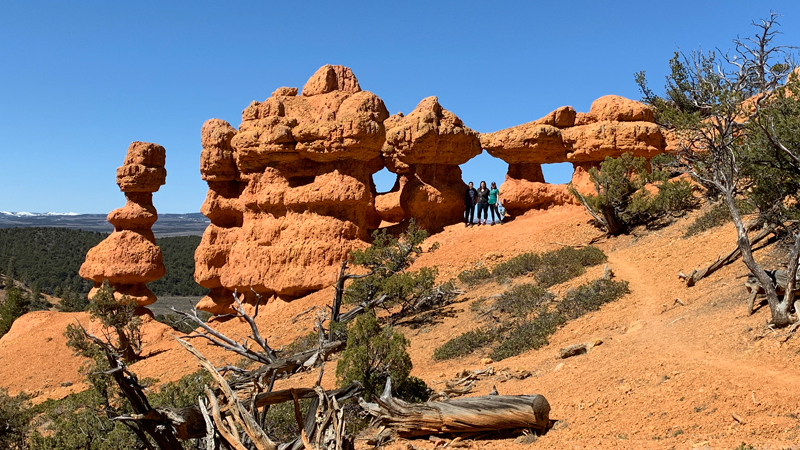
Soon the loop portion of the begins. You start to the right or left — we headed right up the cliffs so the steep part of the hike would be at the beginning not the end. This worked out great because the biggest arch on the trail was right at the beginning of our hike!
As the trail winded around the edge of the cliffs, we passed amazing rock formations and a large eroding wall of rock with several windows — one large enough to stand in!
On the other side of the wall, the trail took us out to an amazing vista point with a breathtaking view of the Sevier River Valley before beginning its descent. The trail down to the canyon floor is steep and slippery. Thankfully, sections of stairs were installed to make it a bit easier to navigate the hike down.
Hiking the Arches Trail with my family was an incredible experience.
Unlike our hikes at Bryce Canyon National Park, this hike took up up close to the hoodoos, windows, and arches and we were able to climb inside and play on them! It was the perfect stop on our way to Zion National Park!
Know Before You Go
- Red Canyon is located just east of the Scenic Byway 12 and Scenic Highway 89 intersection less than 15 miles from Bryce Canyon National Park.
- The Arches Trailhead is at the Losee Canyon Trailhead at 33090, Panguitch, Utah 84759. To reach the trailhead fom the Red Canyon Visitor Center, turn right onto Scenic Byway 12, right onto Casto Canyon Road, then right onto Losee Trailhead Road.
- There is a Port-A-Potty at the Losee Canyon Trailhead.
- The roads to the Losee Canyon Trailhead can become inaccessible at any time during or after a rain storm.
- Red Canyon is part of the Dixie National Forest public lands so there is no fee to visit the canyon.
- The Red Canyon Visitor Center is open Friday through Monday, from 10:00 am to 4:00 pm, from Memorial Day to Labor Day. At the visitor center there are flush restrooms, picnic tables, drinking water, and interpretive displays.
- The Red Canyon Campground is located across the road from the Visitor Center. The 35 acre campground is open from May 1 to October 1.
- From Red Canyon you can also access trails in Losee Canyon and Casto Canyon, also part of Dixie National Forest. Throughout the area, there are miles of hiking trails, ATV trails, horse trails, and paved bicycle trails.


