The reason for our recent weekend getaway to San Francisco was seeing Dark Star Orchestra at the Warfield. We drove down on Friday night to get an early start exploring the city on Saturday so we had time to do pretty much anything we wanted before the concert.
We started the day by climbing the Lyon Street Steps, exploring Crissy Field, and touring Fort Point. After a picnic lunch, we checked out the acoustic Wave Organ and wandered through the Palace Of Fine Arts. By the time we got back to the truck, it was just after 2:00 pm and we only had a couple hours left before we needed to head back to the hotel for dinner and our concert.
Originally, the weekend was also going to include a trip to the Point Reyes Lighthouse, but when we discovered the Point Bonita Lighthouse just across the Golden Gate Bridge, our plans changed. We decided to squeeze in a trip to the Marin Headlands and Point Bonita that afternoon.
When we arrived at Fort Barry, the Point Bonita parking lot was full and every spot along the sides of the road were taken, so we had to park a little more than a quarter mile away and walk to the trail head. This increased our round trip hike from 1.0 mile to 1.6 miles, but it wasn’t that big of deal.
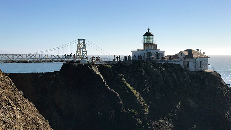
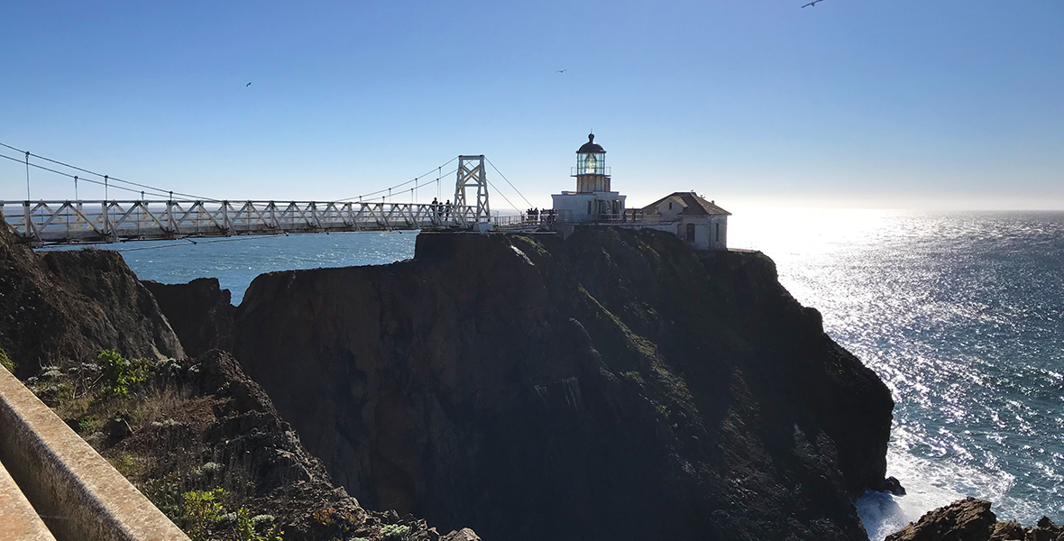
Point Bonita Lighthouse, referred to as the gate keeper to the San Francisco Bay, sits on the rocky promontory of Point Bonita at the entrance to the San Francisco Bay in the Marin Headlands.

Visiting Point Bonita Lighthouse
Our half mile, downhill hike was way more awesome than any of us thought it would be!
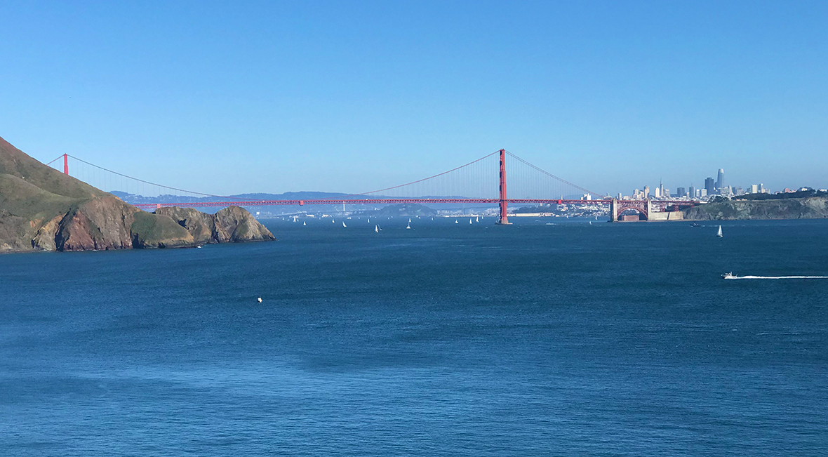
The narrow, winding path curves around the hillside and travels across a bridge, providing majestic views along the way of the Golden Gate Bridge and San Francisco to the left, the pristine Marin coastline to the right, and San Francisco’s Lands End and Ocean Beach straight ahead. And, in case you want to take a break and enjoy the views or the harbor seals sunning themselves on the rocks below, the best vista points also have a bench.
Eventually we reached a dark tunnel that took us right through the basalt mountain and down more narrow trail to a small, flat landing and the entrance to the Point Bointa suspension bridge that connects the walking trail and the lighthouse. Point Bonita Lighthouse is the only lighthouse in America that requires you to cross a suspension bridge to reach it!
Only 49 people are allowed across the suspension bridge at a time, and with around 1,000 people visiting the lighthouse in the three hours it is open each day, it’s inevitable that there is going to be a line. We hopped in line and crossed our fingers that it would move fast because it was already 3:00! Only a small part of the lighthouse property is open to the public, so our wish was granted and not more than 10 minutes later, it was our turn to cross the bridge, which wobbled and shook under our feet like the bridges at children’s playgrounds!
Once on the Lighthouse grounds, there actually wasn’t much to look at other than the incredible views across the water.
It’s a small space crammed with a lot of visitors and you’re standing so close to the lighthouse building that it’s difficult to see the light above. We tried to go inside, but it was lined wall-to-wall with people and the kids and I are short, which meant we couldn’t see anything. Thankfully, the small room in the middle of the building and the one next door were almost empty and we were able to peek at historic photographs, documents, and posters that tell the story of Point Bonita.
After a quick visit, we were ready to head back across the shaky suspension bridge, up the trail, and over to Battery Mendell to do some more exploring before dinner.
Point Bonita Lighthouse History
Point Bonita Light Station, built in 1855, was the third lighthouse built on the west coast of the United States. Unfortunately, its position on the cliffs 306 feet above sea level meant that the 56 foot tall light tower was often engulfed in fog. After several years, authorities determined that a new light tower and fog signal needed to be built on the tip of Point Bonita, 124 feet above sea level where it remained clear.
The rocky, windy terrain made the construction of the new Point Bonita Lighthouse very challenging. The new fog-signal was completed in 1872, but part of the building collapsed into the sea during a storm two years later.
In 1875, the point was leveled for the construction of the new lighthouse and fog-signal building. Then, in 1876, a 118 foot tunnel was cut through the basalt mountainside to move the Fresnel lens from the original lighthouse to the new lighthouse that entered into operation in 1877. Because the new lighthouse used the original lens, it retained its designation as the third lighthouse on the west coast.
The fog-signal building seen today replaced the previous ones in 1903 and after the light keeper’s home was damaged in the 1906 earthquake, it was rebuilt in 1908.
Until 1940, a narrow path connected the lighthouse on the rocky point to the mainland, but severe weather erosion caused the trail to collapse into the ocean. A wooden walkway was built to provide access to the Point Bonita Light Station, but it was dangerous and replaced with a suspension bridge in 1954. While the suspension bridge was repaired in 1979 and 1991, the metal wasn’t able to endure the constant salty spray from the sea and began to rust. In 2010, the suspension bridge was closed to public access due to safety concerns and a new bridge was once again built in its place at the cost of $1 million. It opened in 2012 and is the same bridge you walk across today to access the lighthouse.
Point Bonita Lighthouse was the last manned lighthouse on the California coast and in 1980, became the last California lighthouse to be automated. In 1981, the historic district was transferred to the National Park Service and became part of the Golden Gate National Recreation Area. Then in 1984, the lighthouse opened to the public for tours.
Today the 140 acre Point Bonita Light Station Historic District includes the Point Bonita Lighthouse, the fog signal building, and the tunnel. The lighthouse still uses its original second-order Fresnel lens and remains active and is maintained by the U.S. Coast Guard.

Know Before You Go
- Point Bonita Lighthouse is located at Fort Barry at Field Road, Building PB-0001, Sausalito, California 94965 in Marin County. It is part of the Golden Gate Recreation Area.
- Open Saturdays, Sundays, and Mondays from 12:30 pm to 3:30 pm.
- Admission is free.
- The lighthouse trail is a 0.5 mile out and back trail totaling 1.0 miles round trip that passes over bridges and through a basalt tunnel.
- Approximately 1,000 people visit during the three hour time span and only 49 people are allowed across the bridge at a time. So you may need to wait in line for a bit.
- No dogs or pets are allowed.
- Point Bonita Lighthouse was added to the National Register of Historic Places in 1991.
- Point Bonita was the third lighthouse built on the west coast of the United States. It was originally built in 1855, but was too high on the cliffs and constantly engulfed in fog. So in 1877 it was moved to its current lower location.
- Restrooms are located at the trailhead.


