After visiting the Kīlauea Iki Overlook, Lua Manu Crater, Puhimau Crater, Ko’oko’olau Crater, and Pauahi Crater, it was time to visit the grandaddy of the all, the Mauna Ulu cone and crater.
Located along the east rift zone of Kīlauea, Mauna Ulu is a volcanic cone that erupted in several phases from May 24, 1969 to July 22 of 1974.
As one of the longest known rift zone eruptions of Kīlauea, Mauna Ulu boasted 12 lava fountains between May and December 1969, with the largest towering as high as 1,770 feet, second only to Kīlauea’s 1,900 foot fountain. In Hawaiian culture, this fountain was said to bePele’s brother, Keoʻahikamakaua, the spirit of molten fountains, wielding his spears of lava.
Over five years, the Mauna Ulu eruption produced lava flows that covered 40 square miles, traveled seven miles to the coast, and in some places reached 25 feet deep.
Mauna Ulu means the growing mountain. Standing 400 feet tall from its pre-eruption base, Mauna Ulu buried the original Chain of Craters Road, destroyed forest and grasslands, and added more than 200 acres of new land to the Big Island’s coastline. Today you can hike Mauna Ulu to the 100 foot deep Mauna Ulu Crater.
The Mauna Ulu Crater Eruption Trail
The Mauna Ulu Eruption Trail is a super short 0.1 mile trail to the 1969 eruption fissure and the lava splatter zone (called a rampart).
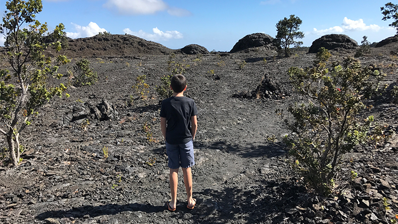
We left the parking area, and followed the trail through the trees then suddenly found ourselves in a huge, black, barren, open field of lava dotted with weird basaltic lava rock formations and tall lava tree molds. It was incredible to learn that this desolate area was once a dense forest landscape, but was destroyed during the Mauna Ulu eruption.
Standing among flows of a’a and pahoehoe lava, it feels like you’re on another planet! The lava tree molds are delicate and fascinating formations and as you walk across the lava field, you can still see steam rising from cracks in the ground. If you look down as you’re walking, you’ll notice glittery, shiny pieces of lava rock that are absolutely stunning.
Know Before You Go
- Mauna Ulu Crater Eruption Trail is located 0.3 miles from Pauhai Crater, 3.7 miles from the start of Chain of Craters Road, and 7 miles from the Kīlauea Visitor Center on Chain Of Craters Road in Hawai’i Volcanoes National Park.
- The Mauna Ulu Crater Eruption Trail will take you into the Mauna Ulu spatter zone with rough a’a lava, smooth pahoehoe lava, odd rock formations, lava trees, and forest trees.
- If the winds are just right, harmful volcanic gasses blow through the area and the park will close it to visitors.
- The hike to Mauna Ulu Crater is 2.5 miles round trip and takes 2-3 hours. It leaves from the parking area and most of the route is easy but includes a quarter mile steep climb up the Pu’u Huluhulu cone.


