Road trips are my favorite type of vacation. We have our space not invaded by rude strangers, we have our own stuff and all of our favorite foods, we’re comfortable and we can do anything and go anywhere we want. Our most recent road trip was to Death Valley National Park. The initial drive from our house to the hotel was 8-9 hours, so we split it up over two days to allow us break up the drive a bit with other fun activities.
We drove the first four hours on Friday night and the rest on Saturday, but we didn’t end up getting to our hotel The Ranch At Furnace Creek until dark because we made two incredible stops along the way, first at Red Rock Canyon State Park and second at Fossil Falls. I had discovered Red Rock Canyon State Park when looking at the map and charting our route to Death Valley, but had no idea Fossil Falls even existed! It wasn’t until we were on the road at Red Rock Canyon that I thought to google things to do near Red Rock Canyon State Park and found Fossil Falls!
The name Fossil Falls is actually a bit misleading — there are no fossils and there is no waterfall. Instead, Fossil Falls is a dry waterfall located in the Coso Range of California carved from basalt lava by ancient water flows and wind and it’s pretty amazing.
Visiting Fossil Falls
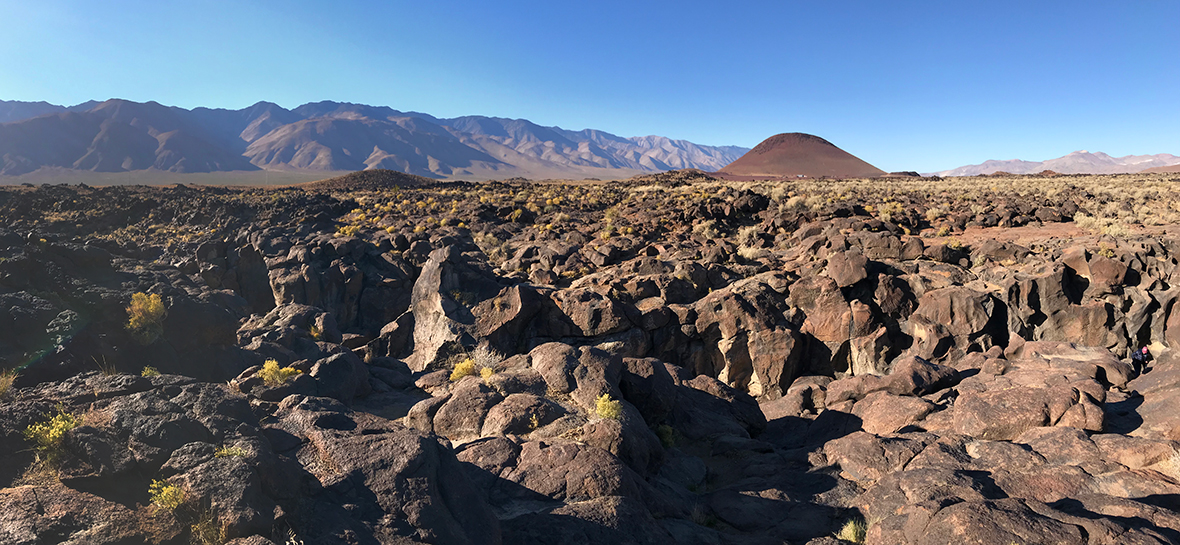
As we drove north toward Death Valley on Highway 395, a large reddish-colored hill came into view. Red Hill, also called Red Cinder Mountain, is the result of a violent eruption of trapped gases and molten material from a vent in the earth’s crust. The materials cooled quickly when exposed to the air, forming a porous red rock called scoria.
Red Hill is the visual signal for the Fossil Falls exit. We followed the dirt road past Red Hill to a parking area with interpretive displays about the area and Fossil Falls. The parking area was lined with piles of volcanic rock and a sign pointed right for Fossil Falls.

We set out on the quarter mile out-and-back trail (a half mile total), or what was sort of a trail, expecting to begin traveling uphill. But that wasn’t the case at all. Instead we were heading out into a vast, flat, desert field dotted with rugged basaltic rock. As we navigated the rocks and tried to stay on what we thought was the trail, we were a bit confused because we saw nothing ahead of us for miles.
How on earth were we going to find a 40 foot dry waterfall in this landscape?
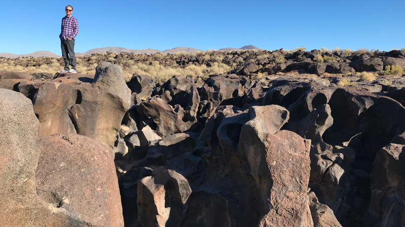
But soon the terrain began to change and the rugged lava rocks transformed into large patches of black, shiny lava that had been sculpted by water and wind and polished smooth thousands of years ago. Then suddenly we found ourselves standing at the top of a basalt canyon that looked like nothing I had ever seen before and realized that we were standing at the top of the dry waterfall!
Unlike the basalt walls and cliffs we saw in the Columbia River Gorge, this basalt canyon didn’t have flat, sheer walls, but curving, winding walls with budges, depressions, twists, turns, and holes — it looked so alien that it felt like we were on a completely different planet.
We followed the ridge of the canyon a ways so we could turn around and look back at Fossil Falls and see the stunning dry waterfall, but ended up finding a second dry waterfall about 200 feet below the first. If you’re careful, you can also climb down the lava canyon walls to the bottom of the canyon and explore it that way.
We spent quite a bit of time checking out all of the strange almost perfectly circular holes in the lava. Some were small mortar grinding holes made long ago by Native Americans and some were large pothole or bowl-like holes. The kids loved climbing in those ones! Apparently at one one point, Red Hill threw granite debris across the surrounding landscape and some the granite chunks fell into Fossil Falls. As the water flowed over, smoothed, polished, and eroded the lava, the granite rocks — too heavy to be carried downstream — got stuck and spun around to create deep, smooth, holes in the lava.
The Formation Of Fossil Falls
During the last ice age, the Pleistocene period, the Sierra Nevada mountains to the west were covered with ice. Several times during this period large lakes formed in many of the basins between here and Death Valley. During these times, the Owens River flowed south out of Owens Lake into Indian Wells Valley. Volcanic eruptions from the Coso Range changed the river’s course at least three times. Fossil Falls was formed when the Owens River was dammed by an eruption and ran over the basalt flows, sculpting and polishing the black rock into the amazing geologic feature seen today.
Native Americans At Fossil Falls
Native Americans lived in this region ten to twenty thousand years ago, camping along the river. They harvested resources and hunted the large animals, but due to increasingly arid conditions, they were forced to partially abandon the region. As conditions shifted once again to a relatively moderate climate (around 4000 BCE), Native Americans returned, practicing a new culture, that emphasized using the natural desert resources available. This way of life supported them until the 19th century, when the native tribe called the Little Lake Shoshone first made contact with Europeans.
While walking to Fossil Falls, Natalie noticed that there were small sparking flakes on the ground among the lava rocks. These flakes are obsidian. The Native Americans, when camped near Fossil Falls, chipped obsidian from the Coso Mountains to form their tools.
Know Before You Go
- Fossil Falls is located off US HWY 395 (on the east side) just north of Little Lake and about 40 miles south of Lone Pine in Inyo County, California. There is only one small sign that reads “Fossil Falls” on the side of the highway just before a large red cinder cone known as Red Hill or Red Cinder Mountain.
- When you turn off the highway, follow unpaved Cinder Road for one mile to the parking area.
- There are vault toilets, a map of the area and informational displays, and picnic tables near the parking area.
- Day use is free.
- The trail to Fossil Falls leaves from the parking area and travels a quarter mile to the site of the volcanic dry waterfall. It’s a relatively easy and flat hike, but it’s best to wear sturdy shoes because at times you’ll have to walk over rugged lava rocks.
- At times it’s hard to actually find the trail among all of the lava rocks. If you lose the trail, just look for painted arrows on the rocks.
- Fossil Falls is an archaeological district on the National Register of Historic Places. Native American artifacts may not be removed from the area.


