When we parked at the Wahkeena Creek Picnic Area just off the Historic Columbia River Highway, and refilled our backpacks with water and snacks, we were only planning on hiking to Wahkeena Falls and then up to Lemmon’s Viewpoint. But when we got to the end/top of the trail and saw a sign pointing to Lemmon’s Viewpoint to the right and Fairy Falls only a half mile to the left, we decided to keep going and visit Fairy Falls too.
If you’re planning to hike to Wahkeena Falls and Lemmon’s Viewpoint, adding on the short hike to beautiful Fairy Falls — only .5 mile each way — is a no-brainer. After all, you’re already more than half way way there!
Hiking to Fairy Falls
The hike to Fairy Falls is an out and back hike that totals 2.8 miles. The first .9 miles, .2 miles to Wahkeena Falls and another .7 miles to Lemmon’s Point, follows the exact same trail as the Wahkeena Trailhead to Lemmon’s Viewpoint hike.
When you get to the top of the hill and the switchbacks end, the paved trail turns to dirt. The trail follows Wahkeena Creek uphill, crossing it twice on small, wooden footbridges, and continuing through the narrow, green, fern-covered, Wahkeena Canyon. With it’s moss covered rock walls and fallen trees, the canyon is just wide enough for the creek and the small trail. We all agreed that Wahkeena Canyon is so quiet and peaceful that it almost seems magical, as if real fairies could be living here, hiding in the trees and ferns.
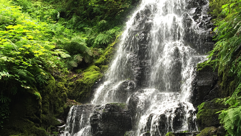
Fairy Falls
Fairy Falls is a 20 foot, fan-shaped waterfall that tumbles over the rocky cliff face of the surrounding mountainside. It is part of a tributary of Wahkeena Creek in the Columbia River Gorge, upstream from Wahkeena Falls.
There is a wooden bench sitting next to the waterfall, and after having climbed about 900 feet in elevation, it provides the perfect place to sit and take a break, enjoy the majestic scenery, grab a drink, and maybe a have snack. A wooden board/plank spans the creek waters at the base of the falls — it is the perfect spot to stand and capture a great photo with the falls in the background.
While tiny compared to the giant waterfalls found in Oregon’s Columbia River Gorge, like Multnomah Falls and Latourell Falls, little 20 foot Fairy Falls may seem like a waterfall you could skip, but don’t! This moderate hike is absolutely gorgeous and falls are like those we’ve seen in Hawaii, just smaller.
Know Before You Go
- Fairy Falls is accessed from the Wahkeena Trailhead located about 13 miles east of Troutdale, Oregon on the Historic Columbia River Highway in Multnomah County.
- For the first .9 miles, the trail to Fairy Falls is the same as the trail from the Wahkeena Trailhead to Lemmon’s Viewpoint.
- Traveling west from the trailhead, it is 3 miles to Bridal Veil Falls, 4.5 miles to Shepperd’s Dell Falls, 5.5 miles to Latourell Falls, 8 miles to Vista House at Crown Point, and 9 miles to the Portland Women’s Forum Overlook. Traveling east, it is .5 miles to Multnomah Falls, 2.5 miles to Oneonta Falls, 3.5 miles to Horsetail Falls, and 7.5 miles to Elowah Falls.
- Water from Wahkeena Falls blows onto the trail, which means the trail can be icy in the winter. Also, once you reach Lemmon’s Viewpoint, the paved trail turns to dirt the rest of the way to Fairy Falls. If it has rained recently, the trail will be muddy and can be slippery in spots. Be very careful and wear good hiking shoes.
- Pack water and a snack! There is a bench just tot he side of Fairy Falls and it’s the perfect spot to take a break and enjoy the gorgeous canyon foliage and waterfall before hiking back down to your car.
- Dogs are allowed on the trail but must be kept on leash.
- Download a Columbia River Highway Waterfall Map, documenting the waterfalls between Corbett and Dodson.
- Download the Historic Columbia River Highway Brochure.


