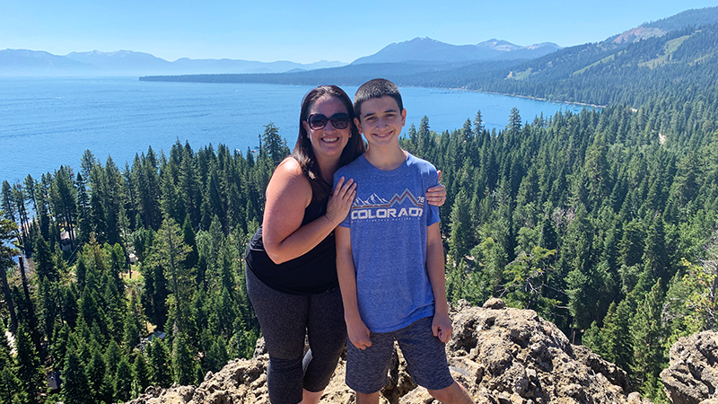
Last year, when Natalie and I took a girls only weekend getaway, Brian and Carter headed to Lake Tahoe to go biking and hiking. One of the hikes they did was the short hike to the summit of Eagle Rock — an eroded dormant volcano. When I saw their pictures, I knew we needed to go back and do the hike as a family.
At 6,286 feet elevation, Eagle Rock Trail is a 0.75 mile, very busy, out and back trail located in Tahoe Pines, between Tahoe City and Homewood, California on SR 89.
We reached the southern Eagle Rock trailhead around 10:00 am on a gorgeous Saturday and snagged one of the last open parking spots. There aren’t very many parking spots, as the parking lot is really just a wide spot on the side of Highway 89!
What I didn’t realize at the time but learned later is that there are parking lots and trailheads on each side of the base of Eagle Rock — one on the north side and one on the south side. This means you can start your hike from either parking lot because the trails merge on the way to the top of Eagle Rock.
Hike To The Top Of Eagle Rock
With an overall elevation gain of only 250 feet, the hike to the top of Eagle Rock only takes about 15-20 minutes. It isn’t a long hike but it is a steep hike. It starts out as a really dusty, dirt trail, but once you reach the back of Eagle Rock and the main uphill climb, it turns to rock and the trail sort of disappears.
While there is a trail to the top of Eagle Rock, it isn’t marked or well defined. You simply do your best to stay on the trail, keep moving in the same direction, and climb the volcanic rock on the best path you can find. When climbing the rocks, it can be a bit difficult, especially if you’re not used to the elevation.
As you reach the summit of Eagle Rock, the stunning, sparkling blue water of Lake Tahoe stretches beyond the shoreline of pine trees. The panoramic views of Lake Tahoe, the Sierra Nevadas, Desolation Wilderness, and the Carson Range from this scenic viewpoint are spectacular. After checking out the two USGS markers atop Eagle Rock, we climbed all over the rocky landscape, snapping photos, relaxing, and simply taking in the view.
But soon our tummies began to growl. It was lunch time and we were ready to head over to Commons Beach in Tahoe City for a picnic and some kayaking!
Know Before You Go
- Eagle Rock is located on the West Shore of Lake Tahoe adjacent to Blackwood Creek, approximately 5 miles south of Tahoe City, in Tahoe Pines, California.
- Eagle Rock Trail is open for public use. A kiosk provides on-site information.
- Parking for the Eagle Rock Trailhead is easy to find and easy to miss! There are two small parking areas on each side of Eagle Rock, each with a trailhead, right on the side of the road on State Route 89 between mile markers 67 and 68.
- There is only room for about 10-12 vehicles in parking spaces, so you may not find a spot mid-day, or you may have to park along the road and walk in.
- There are no restrooms at the trailhead.
- If you’re looking for a longer hike, you can turn it into a full loop and extend the hike through the surrounding pine forest.
- Dogs are allowed on leash and dog owners must pick up after their pets.
- The California Tahoe Conservancy purchased the 54.5 acre parcel Eagle Rock sits on in 1987 and the Eagle Rock trails were severely eroded. During the summer of 2011, The Conservancy and California Conservation Corps crews constructed the new trails and parking areas you use today.


