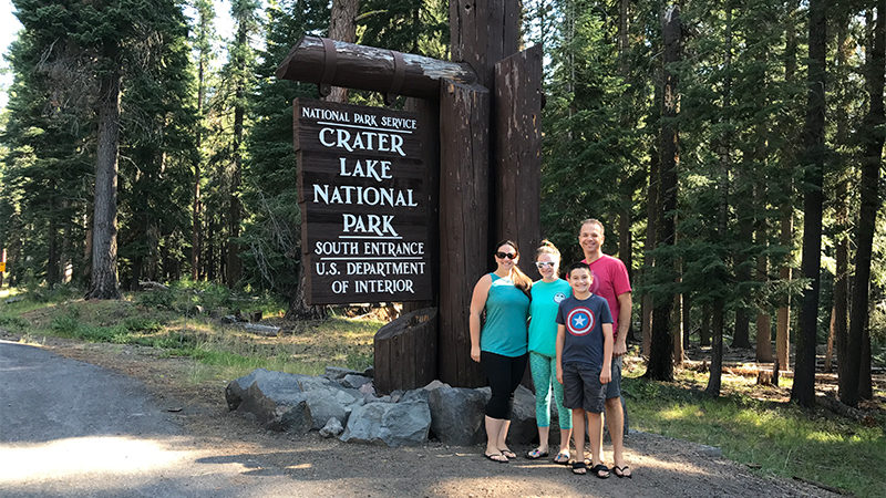
With a depth of 1,943 feet, Crater Lake is the deepest lake in the United States, the second deepest lake in North America, and the ninth deepest lake in the world. When referring to average depth, however, Crater Lake — at an average of 1,148 feet deep — is the deepest lake in the Western Hemisphere and the third deepest in the world.
Crater Lake is also an incredibly beautiful lake. Surrounded by lava cliffs, the sparking blue lake is fed entirely by rain and snow. Because there are no streams flowing in or out of the lake, there is no sediment clouding the water. As a result, scientists consider it to be the cleanest and clearest large body of water in the world.
Adventure Around A Collapsed Volcano
Crater Lake sits in the caldera of a dormant volcano that once stood 12,000 feet tall. Mount Mazama violently erupted 7,700 years ago, spewing so much debris into the atmosphere and surrounding landscape that the mountain collapsed and created an enormous crater over 5.0 miles in diameter and nearly 4,000 feet deep. 200 to 300 feet of ash settled at the base of Mazama.
The lake has two islands: a cinder cone named Wizard Island and a natural rock formation pillar called Phantom Ship Island because it looks like a pirate ship or ghost ship.
Crater Lake National Park
In 1902, President Theodore Roosevelt established Crater Lake National Park as Oregon’s only national park and the United States’ fifth national park.
While the lake is the national park’s main attraction, it actually occupies less than 10% of the park. The national park also protects 15 species of conifers, from towering ponderosa pines and ancient whitebark pines to mountain hemlocks, that offer shelter for wildlife like black bears, mountain lions, elk, and spotted owls.
There are three man-made areas of Crater Lake National Park:
- The Rim Village sits right on the edge of the lake and is home to the Sinnott Memorial Observation Station, Rim Village Visitor Center, and the historic Crater Lake Lodge, which was constructed between 1909 and 1915. The Kiser Studio, constructed in 1921 by photographer Fred Kiser, Plaza Comfort Station, and a gift shop are all in this area too.
- The Park Headquarters, also known as the Munson Valley Historic District, is home to the Park Headquarters and the Steel Visitors Center. Residences for rangers, the superintendent, researchers and other facilities for park administration are located in this area.
- Mazama Village is home to a campground, cabins, a camp store, and Annie Creek Restaurant. It also provides access to the Annie Spring Canyon Trail and Godfrey Glen Trail.
Rim Drive Around Crater Lake
Crater Lake National Park’s Rim Drive is a narrow, steep, 33.0 mile road that circles Crater Lake.
Rim Drive is located in the Cascade Mountains. Its lowest point sits at 6,500 feet elevation and its highest point atop Cloudcap sits at 7,900 feet elevation. Most of the road hugs the lake’s caldera rim, offering breathtaking views of the lake, it’s steep cliffs, and the surrounding mountains. It is a stunning drive, as the color of the water, views, and light changes as you make your way around the lake. There are more than 30 scenic viewpoints, overlooks, and roadside pullouts along Rim Drive — and many of the stops have informational signs that provide details on the area’s geology, the view, or history.
- West Rim Drive connects the Crater Lake National Park Park Headquarters in Munson Valley, Rim Village, and the North Junction: where the North Entrance Road meets Rim Drive. The 10 mile stretch of road has more traffic than East Rim Drive because it is the main route that connects the park’s North and South Entrance Stations.
- East Rim Drive travels 23 miles from North Junction all the way around the lake back to the Park Headquarters. The busiest section of this road is around Cleetwood Cove: where visitors leave their vehicles and cross the highway to follow the trail down to the surface of Crater Lake.


Exploring The National Park
We visited Crater Lake National Park in late July and did the entire scenic drive on Rim Drive around Crater Lake, stopping at almost every viewpoint and attraction. While some trails and areas of the park were still closed due to snow (Yes, even in late July), we got to experience two majestic waterfalls, family-friendly hiking trails, cool lava formations, beautiful wildflower blooms, and spectacular scenic viewpoints. It took us the entire day and was so much fun!
Don’t want to drive Rim Drive yourself? No problem! You can hop aboard a trolley at Rim Village that loops the entire scenic drive. Experienced captains drive the trolley, while park rangers narrate the tour and provide facts and insights about Crater Lake and its surrounding areas. The tour lasts about two hours and includes at least five stops at popular scenic viewpoints.
Here are 20 fun, family-friendly things to do and see at Crater Lake National Park:
01. Fossilized Steam Vents In Annie Creek Canyon
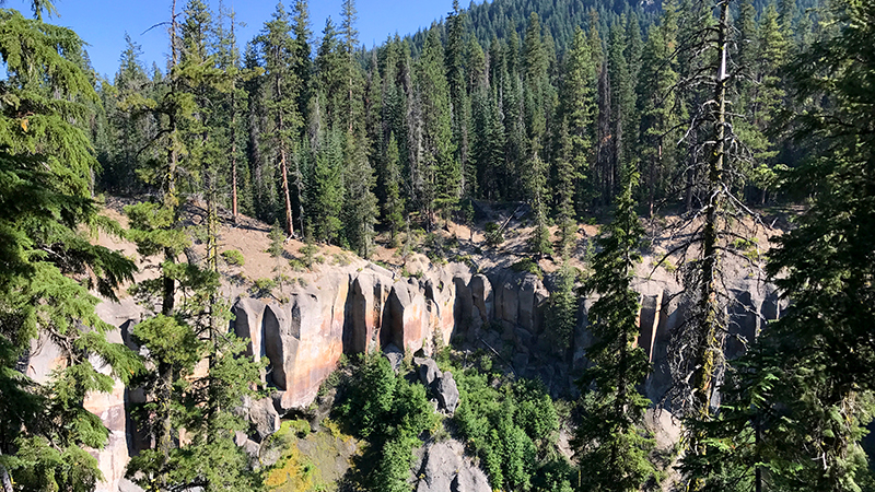
Annie Creek flows beside Highway 62 for more than 10.0 miles. Half of that distance, which includes a large waterfall, runs through a deep, stream-cut canyon bordered by vertical pumice cliffs that have eroded into pinnacles and vertical shafts.
02. Crater Lake Lodge
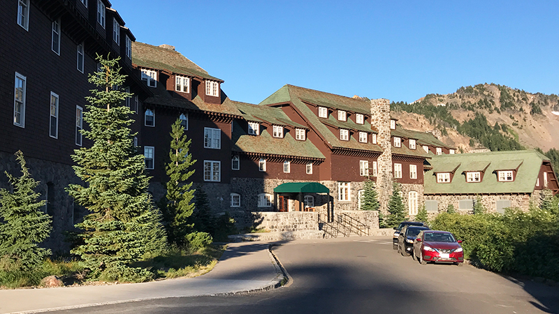
Perched on the southwestern rim of the Crater Lake caldera in Oregon’s only national park, the seasonal Crater Lake Lodge has been an area landmark since 1915. With big bold fireplaces, rich warm hues, and rustic furnishings, the charming, cozy lodge has a historic 1920s feel. It was fully renovated in 1995 and has 71 guest rooms — all just a little different.
03. Sinnott Memorial Observation Station
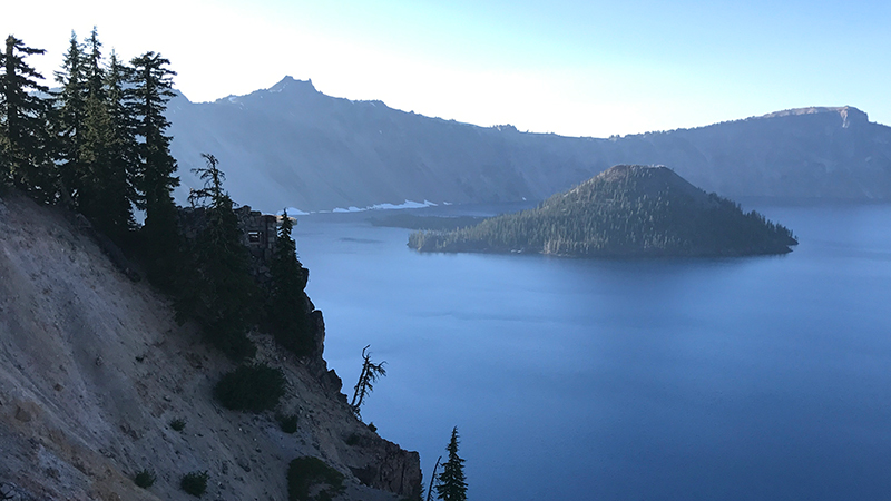
The Sinnott Memorial Observation Station is a small natural history museum and scenic viewpoint that sits on Victor Rock, 900 feet above the surface of Crater Lake and 7100 feet above sea level. A short but steep, historic walkway with stone stairs and breathtaking views leads from Rim Village to the Overlook’s 40 foot by 40 foot enclosed exhibit and observation room and a covered open-air balcony that delivers spectacular views of Crater Lake, Wizard Island, Llao Rock, and on a clear day, Mount Thielsen outside the national park.
04. Discovery Point
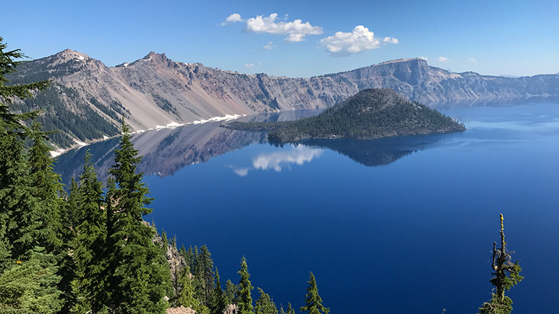
Discovery Point Overlook is the spot where gold prospector John Wesley Hillman first spotted Crater Lake in 1853, calling it “Deep Blue Lake.” The Discovery Point Trail, a part of the larger Rim Trail, travels northwest along the rim of Crater Lake through a beautiful forest of mountain hemlocks and whitebark pines.
05. Watchman Overlook
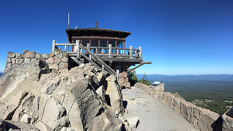
Watchman Overlook is located 3.7 miles northwest of Rim Village on West Rim Drive. From the overlook, enjoy amazing views of Watchman Peak, Crater Lake, and Wizard Island, a cinder cone that erupted in Crater Lake nearly 7,500 years ago. The view was awesome that we decided to have our picnic lunch here!
06. Merriam Point
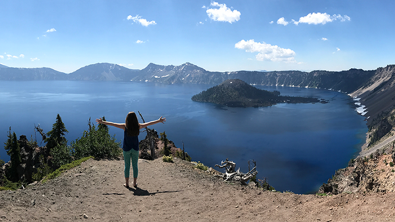
Merriam Point Overlook boasts panoramic views of Mount McLoughlin and Mount Scott, Llao Rock, and Wizard Island. Located at the junction of Volcanic Legacy Scenic Byway and Rim Drive, Merriam Point is often the first scenic viewpoint experienced by visitors who enter Crater Lake National Park through its North Entrance.
07. Llao Rock
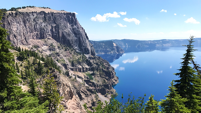
With its face standing 1200 feet tall, Llao Rock is one of the highest points on the rim of Crater Lake’s caldera, reaching an elevation of 8,046 feet. It was named by William Gladstone Steel after the Native American god Llao who ruled the “below world” and lived beneath Mt. Mazama.
08. Pumice Point
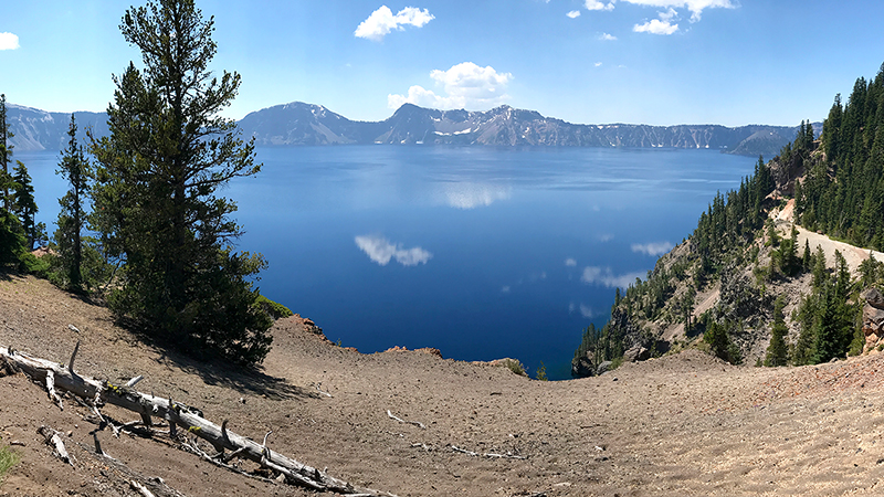
Pumice Point is a 47 foot tall, white-faced cliff that lies beneath Grouse Hill on Crater Lake’s north rim opposite Crater Lake Lodge and Rim Village. The formation, which sits on a rocky point created by glaciated crust, topmost lava, and glacial sand, consists of large, coarse, white pumice mixed with large blocks of andesite.
09. Palisade Point
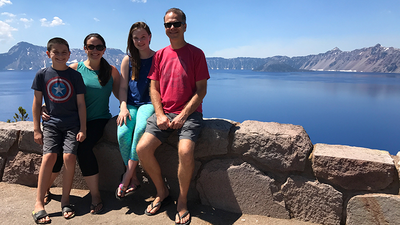
At 507 feet elevation, Palisade Point is the lowest point on the rim of Crater Lake. Palisade Point marks the east side of Cleetwood Cove. The low-walled overlook sits atop the point and provides sweeping views of Crater Lake.
10. Wineglass Viewpoint
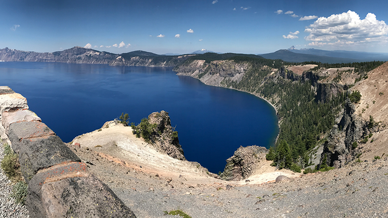
Found on the northern wall of the Crater Lake caldera, Wineglass is a slide formation called a scree chute, that looks like a giant wine glass or martini glass when seen from across the lake. The wineglass formation sits below the overlook, so you can’t actually see it from this viewpoint.
11. Cloudcap Overlook
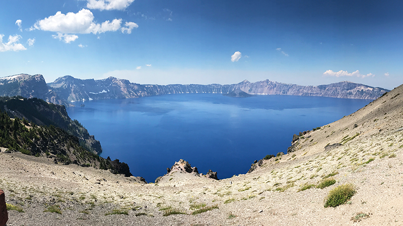
Cloudcap Overlook sits at the end of a 1.0 mile spur road off Rim Drive — the highest paved road in Oregon leads to the highest Crater Lake overlook.
12. Pumice Castle
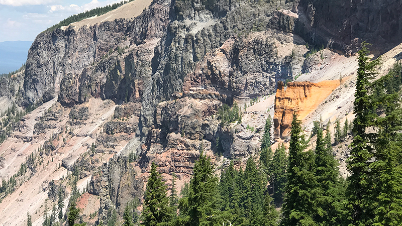
Pumice Castle, also called Castle Rock, is a colorful, bright orange and pink volcanic formation shaped like a medieval castle. Sitting 1,300 feet above the surface of the lake, the formation is part of a bed of fragmental pumice outcropping on the east caldera wall of Crater Lake that reaches up to 190 feet thick.
13. Sentinel Rock Overlook
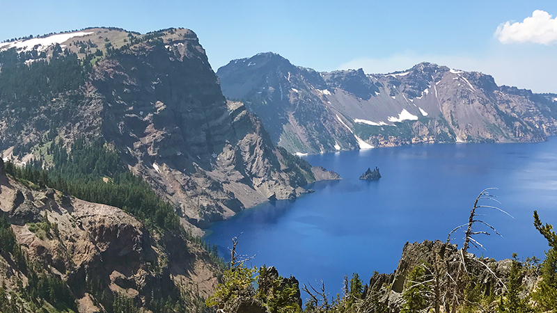
Sentinel Rock is a bald rock formation on the southeastern rim of Crater Lake that rises to 6,378 feet elevation. From the Sentinel Rock Overlook, you can see across Crater Lake and see both Wizard Island and Phantom Ship Island, which looks small but rises 160 feet out of the lake.
14. Kerr Notch Phantom Ship Overlook
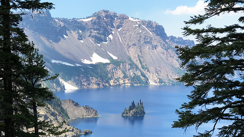
Named for United States Geological Survey topographer Mark Brickell Kerr, Kerr Notch is a u-shaped valley that was carved by glaciers moving down the side of Mount Mazama more than 10,000 years ago. The best thing about our stop at Kerr Notch was the view of Phantom Ship, a 400,000 year-old eroded remnant of a volcanic dike that is 170 feet tall, 500 feet long, and 200 feet wide.
15. The Pinnacles
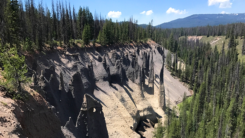
The pinnacles are a collection of volcanic pumice spires called fossil fumaroles that stand up to 100 feet tall along the south edge of Wheeler Creek, a tributary of Sand Creek. The Pinnacles Trail is an easy, 0.5 mile, out and back trail along the rim of Pinnacle Valley that totals 1.0 mile.
16. Plaikni Falls
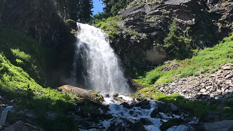
The Plaikni Falls Trail travels through a quiet old-growth Hemlock and Fir forest, along rocky bluffs flanking Sand Creek to the base of a 20 foot waterfall cascading down a glacier-carved cliff of petrified volcanic ash. The trail, which opened in 2011, is an easy to moderate, 1.1 mile out-and-back trail that totals 2.2 miles round trip.
17. Sun Notch Phantom Ship Overlook
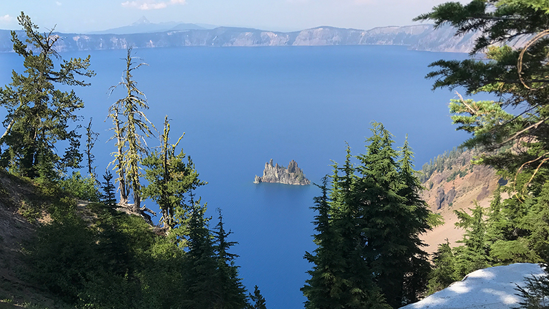
Sitting on the southeast end of the Crater Lake caldera, Sun Notch is a lush green meadow and Sun Notch Trail is an easy, 0.9 mile loop trail. It only took us about 30 minutes or so to walk the trail, take in the views, and snap a bunch of photos — and it was well worth the stop.
18. Vidae Falls
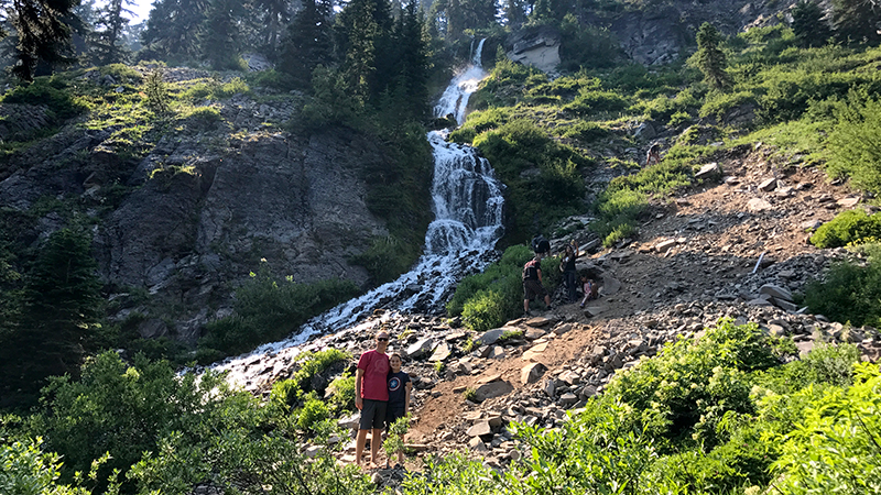
Vidae Falls is a part of Vidae Creek, which flows from small, consistent spring near the Crater Lake caldera rim 600 feet above the lake’s surface. The magnificent waterfall tumbles down a rocky, forested, glacier-carved cliff, dropping 100 feet before cascading over a talus slope, into a small pool, and disappearing beneath Crater Rim Drive.
19. Castle Crest Wildflower Trail
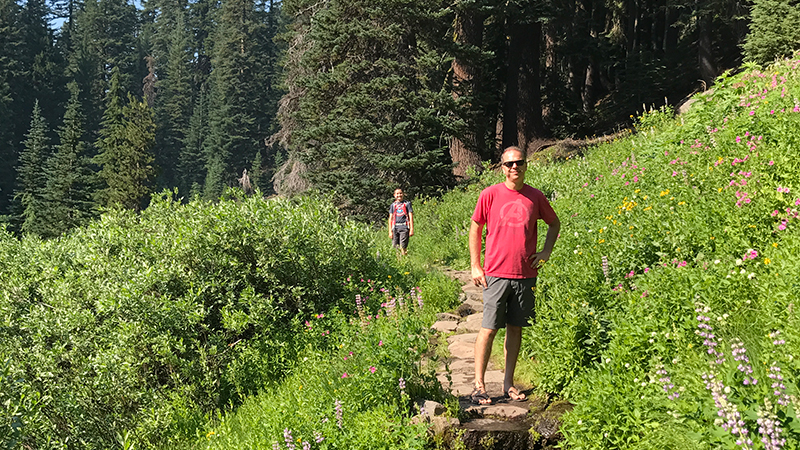
The Castle Crest Wildflower Trail, originally called Castle Crest Garden, is an easy, 0.5 mile loop trail through a beautiful meadow below Castle Crest Ridge. The Castle Crest Garden was established in 1929 with the planting of some 200 species of park flowers in the garden. It was the first wildflower garden and trail planned, constructed, and used specifically for visitor education by the national park.
20. Godfrey Glen Loop Trail
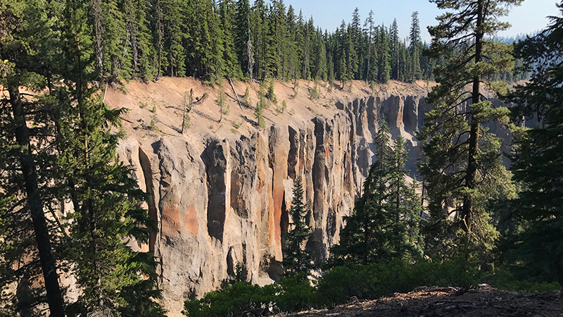
Godfrey Glen is lined with columnar ash formations that were formed when trapped gases pushed their way up through volcanic ash deposits from the eruption of Mount Mazama 7,700 years ago. Godfrey Glen Loop Trail is an easy, 1.0 mile loop trail that traverses an old growth mountain hemlock and Shasta red fir forest on the edge of Munson Creek Canyon and Annie Creek Canyon.
Know Before You Go
- Crater Lake National Park, Oregon’s only national park, does not have a physical street address, so it can be hard to locate us using GPS. We made the historic Crater Lake Lodge our first stop, which is located at 565 Rim Drive, Klamath Falls, Oregon 97604.
- At 1,943 feet deep, Crater Lake is the deepest lake in the United States and the principal feature of Crater Lake National Park.
- The 33 mile Rim Drive that travels around Crater Lake’s caldera was added to the National Register of Historic Places in 2008. It features spectacular views of the lake and interpretive signage at all of the main vista points.
- The national park is open year-round, 24 hours a day but many of the park’s roads, trails, and facilities are closed seasonally.
- Good for seven days, admissions fees are $30.00/vehicle, $25.00/motorcycle in the summer and $15.00/motorcycle in the winter, and $15.00/pedestrian or bicycle.
- Crater Lake is one of the snowiest inhabited places in the United States, getting an average of 43 feet of snow at Park Headquarters.
- During periods of rain and snow, Crater Lake is often hidden by clouds — it is completely invisible about 50% of the time in the winter!
- Summers at Crater Lake are short but typically sunny. July, August, and September are your best bets for warm, dry weather. However, it can snow any day of the year.
- The park’s North Entrance is closed for about seven months each year. It closes at the first snowfall or on November 1, whichever comes first and reopens in early to mid-summer. The park’s South Entrance and West Entrance are open year-round. We visited the park in late July and the roads had only been open for a week!
- There are three restaurants in the national park. The Rim Village Café serves light fare including grab-and-go sandwiches, salads, soup, and snacks is open year-round. Annie Creek Restaurant and Crater Lake Lodge are open seasonally. There is also the Mazama Village Store that sells groceries, camping supplies, firewood, and gasoline.
- Crater Lake National Park has two visitor centers. The Steel Visitor Center at Park Headquarters is open every day except December 25 — 9:00 am to 5:00 pm from mid-April to early November and 10:00 am to 4:00 pm the rest of the year. The Rim Visitor Center at Rim Village is open daily from late May to late September from 9:30 am to 5:00 pm.
- Three historic San Fransisco style trolleys travel around the lake on Rim Drive providing a two hour Crater Lake Trolley tour. Conducted by park rangers, the tour makes periodic stops at points of interest for photo opportunities. There are also boat tours on the lake, some with options to stop at Wizard Island.
- Lodging is available at Crater Lake National Park from late-May to mid-October. Crater Lake Lodge has 71 rooms and the Mazama Village Campground has 40 guestrooms in cabins. There are also backcountry campsites available. The lodge was added to the National Register of Historic Places in 1981.
- Unleaded gas is available seasonally at the Mazama Village Store. The rest of the year, the closest gas stations are in the towns of Prospect and Chiloquin about 35 miles south of Park Headquarters.
- Dogs on-leash are permitted only in developed park areas, Mazama Village, and Lost Creek Campground. Dogs are not permitted on any trails or in undeveloped areas.