After hiking Death Valley’s Golden Canyon, we drove out to the Badwater Salt Flats in Badwater Basin, stopping at Devil’s Golf Course on the way. Now, the name Devil’s Golf Course is a bit misleading and disappointing for golfers who are ready for a game of golf because this isn’t actually a golf course!
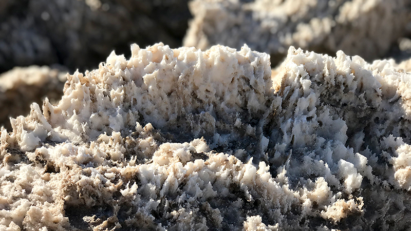
Unlike the flat, smooth Badwater Salt Flat, Devil’s Golf Course is a salt flat with thousands of miniature, jagged salt pinnacles that have been eroded by heat, wind, and rain into a variety of weird and wild shapes. The texture of the salt flat and halite salt crystal formations are so rough and sharp that even a 1934 National Park Service manual stated “only the Devil could play golf on such rough links”.
Visiting Devil’s Golf Course
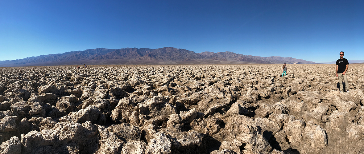
The Devil’s Golf Course parking area, with interpretive displays, is right in the middle of Devil’s Course Course. When we got out of the car, we were surrounded by uneven, rough, alien-like, ground stretching out in all directions. At first, it looked like carved up rock, but when you get closer, it’s easy to see hundreds of thousands of small salt crystals covering the craggy, rugged terrain.
Venturing out into Devil’s Golf Course is allowed, but there are signs warning visitors of the risks associated with walking into the harsh, rigid spires: “a fall could result in painful cuts or even broken bones.”
Luckily we all were wearing solid shoes, so we carefully walked out to explore the unique salt pinnacles and formation up close. The pinnacles grow very slowly, as little as an inch in 35 years, so it’s very important to be mindful about where you step in this salt field and avoid crushing the tiny, delicate salt pinnacles.
We went slow, stepping only on flat sections of rock salt, small areas devoid of pointy sharp salt spires, or formations already smoothed from other people stepping in that spot.
Devil’s Golf Course was incredible and unlike anything we have ever seen! The kids said it was like being on another planet.

How Devil’s Golf Course Was Formed
About 10,000 years ago, Lake Manly covered the bottom of Death Valley in 30 feet of water. The vast salt pan covering Badwater Basin in Death Valley National Park that you see today was created by minerals dissolving in the water and being left behind when the lake eventually evaporated.
Here’s the thing: The salt pan at Badwater is flat and at Devil’s Golf Course just a short ways away, it is shaped into hard, jagged, rock-like formations with tiny salt spires. Why is that?
- Badwater Basin periodically floods, then dries and evaporates. This smooths out the salt pan into a salt flat.
- The Devil’s Golf Course area of the salt pan, sits several feet above flood level. Without the smoothing effects of the flood waters, the salt is pushed up through the mud by pressure created when underground salt- and water-bearing gravel crystallize. Then the water quickly evaporates, leaving a salty residue behind that is sculpted by weather into amazing, intricate formations.
Before Death Valley became a national monument in 1934, the Pacific Coast Borax Company drilled exploratory holes in the area. Through their efforts, it was discovered that the salt and gravel beds of Devil’s Golf Course extend to a depth of more than 1,000 feet. Later studies suggest that in places the depth ranges up to 9,000 feet!
Many Death Valley National Park visitors skip Devil’s Golf Course because they’re in a hurry to visit the Badwater Salt Flat, the lowest point int he continental United States at 282 feet below sea level. And I’ll be honest, if I didn’t know what Devil’s Golf Course was in advance, we may have done the same. After all, if you look out toward Devil’s Golf Course while driving down Badwater Road, it doesn’t look like anything but lumpy dirt.
Don’t make this mistake! The rugged salt formations and millions of tiny, hard, sharp salt pinnacles are fascinating. I promise, visiting this rough terrain will make you feel like you’re on a completely different planet.
Know Before You Go
- Devil’s Golf Course (not an actual gold course) is located about 20 minutes south of Furnace Creek off Badwater Road in Death Valley National Park, California 92328.
- The 1.3 mile access road is unpaved and leads to a parking area for about a dozen vehicles.
- There are interpretive displays at the parking area but no trails.
- While you are allowed to walk out into the Devil’s Golf Course to view the thousands of miniature salt pinnacles close up, it is not recommended because the terrain is uneven and the salt pinnacle are very, very sharp. If you do venture out among the salt pinnacles, be very careful!
- There are no restrooms at this location.


